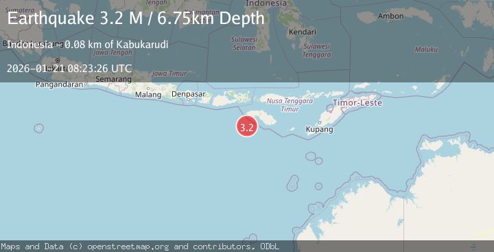
Earthquake Sumba Region, Indonesia
Wed, 21 Jan 2026 08:23:26 GMT
Time6 days ago
Location
-10.3562, 119.0018
Depth
6.7 KM
Event Summary
A 3.2 magnitude earthquake struck on Sumba Region, Indonesia, at Wed, 21 Jan 2026 08:23:26 GMT. Depth: 6.748963km. Reviewed by BMKG seismologists, this minor quake occurred at a magnitude type of M.
Magnitude
3.2
M
Source
BMKG
Intensity
-
Agency Reports
1 Sources| Source | Magnitude | Depth | Time |
|---|---|---|---|
| BMKGPrimary | 3.2 | 7 km | 6 days ago |
Earthquake Details
AutomaticEvent IDbmg2026bler
Tsunami PotentialNo
Magnitude TypeM
Nearest Places
- Watu Kalode70.0 km
- Tanjung Mambang70.3 km
- Tanjung Toroha70.5 km
- Loko Watukalabar70.8 km
- Teluk Katobo70.8 km
Comments
Join the discussion about this event.
Latest Earthquakes
2.2Mag
NEVADA
Time18 hours ago
Depth8.30 km
SourceNN (Automatic)
1.8Mag
13 km SSE of Volcano, Hawaii
Time18 hours ago
Depth3.46 km
SourceUSGS (Automatic)
1.4Mag
10 km N of Hollister, CA
Time18 hours ago
Depth10.13 km
SourceUSGS (Automatic)
1.2Mag
13 km WSW of Stanton, Texas
Time18 hours ago
Depth3.46 km
SourceUSGS (Automatic)
3.5Mag
South of Java, Indonesia
Time18 hours ago
Depth175.60 km
SourceBMKG (Automatic)
Nearby Earthquakes
2.5Mag
Sumba Region, Indonesia
Time1 day ago
Depth34.19 km
SourceBMKG (Automatic)
2.5Mag
Sumbawa Region, Indonesia
Time3 days ago
Depth0.00 km
SourceBMKG (Automatic)
2.7Mag
South of Sumbawa, Indonesia
Time1 day ago
Depth10.00 km
SourceBMKG (Automatic)
2.4Mag
Sumbawa Region, Indonesia
Time23 hours ago
Depth10.00 km
SourceBMKG (Automatic)
2.6Mag
Sumbawa Region, Indonesia
Time5 days ago
Depth13.04 km
SourceBMKG (Automatic)