Earthquake 10 km N of Hollister, CA
Mon, 26 Jan 2026 21:36:10 GMT
Time11 hours ago
Location
36.9333, -121.4157
Depth
10.1 KM
Event Summary
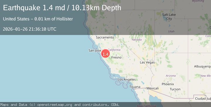
A 1.4 magnitude earthquake struck on 10 km N of Hollister, CA, at Mon, 26 Jan 2026 21:36:10 GMT. Depth: 10.1300001144409km. Reviewed by USGS seismologists, this minor quake occurred at a magnitude type of md.
Magnitude
1.4
md
Source
USGS
Intensity
-
Agency Reports
1 Sources| Source | Magnitude | Depth | Time |
|---|---|---|---|
| USGSPrimary | 1.4 | 10 km | 11 hours ago |
Earthquake Details
AutomaticEvent IDusgs_nc75302166
Tsunami PotentialNo
Magnitude Typemd
Nearest Places
- Santa Ana Creek0.6 km
- Dunneville0.9 km
- Pacheco School1.3 km
- Hollister Valley2.3 km
- Ausaymas School2.7 km
Comments
Join the discussion about this event.
Latest Earthquakes
1.2Mag
13 km WSW of Stanton, Texas
Time11 hours ago
Depth3.46 km
SourceUSGS (Automatic)
3.5Mag
South of Java, Indonesia
Time11 hours ago
Depth175.60 km
SourceBMKG (Automatic)
2.0Mag
WESTERN TURKEY
Time11 hours ago
Depth7.60 km
SourceKOERI (Automatic)
4.4Mag
Sulawesi, Indonesia
Time11 hours ago
Depth5.00 km
SourceBMKG (Automatic)
1.1Mag
11 km N of Quilcene, Washington
Time11 hours ago
Depth20.76 km
SourceUSGS
Nearby Earthquakes
1.4Mag
18 km NNE of Hollister, CA
Time1 day ago
Depth10.28 km
SourceUSGS (Automatic)
1.1Mag
6 km SE of San Juan Bautista, CA
Time4 days ago
Depth5.17 km
SourceUSGS (Automatic)
2.1Mag
CENTRAL CALIFORNIA
Time5 days ago
Depth6.20 km
SourceNC (Automatic)
1.5Mag
13 km SSW of Tres Pinos, CA
Time4 days ago
Depth1.38 km
SourceUSGS (Automatic)
2.0Mag
14 km S of Tres Pinos, CA
Time4 days ago
Depth2.18 km
SourceUSGS (Automatic)