Earthquake Northern Molucca Sea
Wed, 21 Jan 2026 16:19:22 GMT
Time5 days ago
Location
2.7378, 126.7828
Depth
10.0 KM
Event Summary
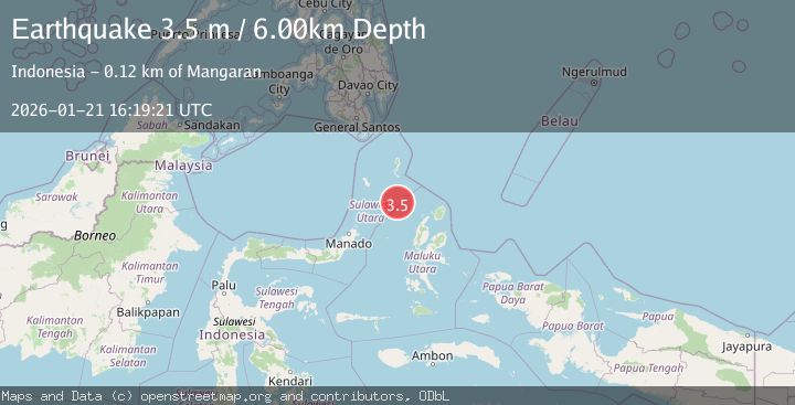
A 3.5 magnitude earthquake struck on Northern Molucca Sea, at Wed, 21 Jan 2026 16:19:22 GMT. Depth: 10km. Reviewed by BMKG seismologists, this minor quake occurred at a magnitude type of M.
Magnitude
3.5
M
Source
BMKG
Intensity
-
Agency Reports
1 Sources| Source | Magnitude | Depth | Time |
|---|---|---|---|
| BMKGPrimary | 3.5 | 6 km | 5 days ago |
Earthquake Details
AutomaticEvent IDbmg2026bluj
Tsunami PotentialNo
Magnitude TypeM
Nearest Places
- Pulau Napumbalu100.5 km
- Pulau Karis101.2 km
- Tanjung Pallo110.3 km
- Taduwale111.3 km
- Tanjung Tatimbalangan111.7 km
Comments
Join the discussion about this event.
Latest Earthquakes
4.4Mag
Sulawesi, Indonesia
Time16 hours ago
Depth5.00 km
SourceBMKG (Automatic)
2.6Mag
Minahassa Peninsula, Sulawesi
Time17 hours ago
Depth118.00 km
SourceBMKG (Automatic)
2.8Mag
South of Bali, Indonesia
Time17 hours ago
Depth10.00 km
SourceBMKG (Automatic)
1.7Mag
31 km SE of Denali National Park, Alaska
Time17 hours ago
Depth0.60 km
SourceUSGS (Automatic)
2.2Mag
WESTERN TURKEY
Time17 hours ago
Depth14.90 km
SourceKOERI (Automatic)
Nearby Earthquakes
3.2Mag
Northern Molucca Sea
Time4 days ago
Depth10.37 km
SourceBMKG (Automatic)
3.1Mag
Northern Molucca Sea
Time2 days ago
Depth61.58 km
SourceBMKG (Automatic)
3.5Mag
Northern Molucca Sea
Time3 days ago
Depth17.49 km
SourceBMKG (Automatic)
3.6Mag
Talaud Islands, Indonesia
Time5 days ago
Depth5.61 km
SourceBMKG (Automatic)
3.0Mag
Northern Molucca Sea
Time1 day ago
Depth100.85 km
SourceBMKG (Automatic)