Earthquake Northern Molucca Sea
Thu, 22 Jan 2026 19:22:15 GMT
Time4 days ago
Location
2.5994, 127.1746
Depth
10.4 KM
Event Summary
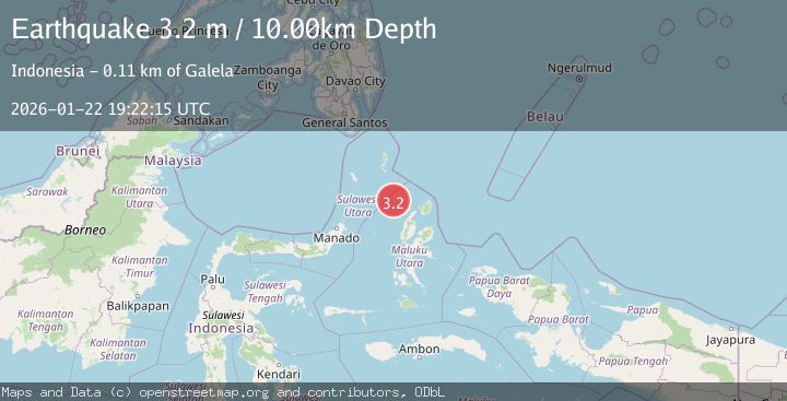
A 3.2 magnitude earthquake struck on Northern Molucca Sea, at Thu, 22 Jan 2026 19:22:15 GMT. Depth: 10.370983km. Reviewed by BMKG seismologists, this minor quake occurred at a magnitude type of M.
Magnitude
3.2
M
Source
BMKG
Intensity
-
Agency Reports
1 Sources| Source | Magnitude | Depth | Time |
|---|---|---|---|
| BMKGPrimary | 3.2 | 10 km | 4 days ago |
Earthquake Details
AutomaticEvent IDbmg2026bnvx
Tsunami PotentialNo
Magnitude TypeM
Nearest Places
- Pulau Deherete72.7 km
- Pulau Laba74.2 km
- Pulau Sedeng74.9 km
- Tanjung Gurama75.6 km
- Desa Cera75.7 km
Comments
Join the discussion about this event.
Latest Earthquakes
3.7Mag
Java, Indonesia
Time7 minutes ago
Depth26.88 km
SourceBMKG (Automatic)
1.7Mag
20 km ENE of Arvin, CA
Time8 minutes ago
Depth5.64 km
SourceUSGS (Automatic)
2.3Mag
57 km E of Pedro Bay, Alaska
Time13 minutes ago
Depth120.40 km
SourceUSGS (Automatic)
2.3Mag
Bali Sea
Time15 minutes ago
Depth13.31 km
SourceBMKG (Automatic)
1.9Mag
97 km S of Kokhanok, Alaska
Time19 minutes ago
Depth5.00 km
SourceUSGS (Automatic)
Nearby Earthquakes
3.0Mag
Northern Molucca Sea
Time2 days ago
Depth100.85 km
SourceBMKG (Automatic)
3.5Mag
Northern Molucca Sea
Time5 days ago
Depth10.00 km
SourceBMKG (Automatic)
3.5Mag
Northern Molucca Sea
Time3 days ago
Depth17.49 km
SourceBMKG (Automatic)
3.2Mag
Halmahera, Indonesia
Time1 day ago
Depth114.35 km
SourceBMKG (Automatic)
3.9Mag
Halmahera, Indonesia
Time6 days ago
Depth10.00 km
SourceBMKG (Automatic)