Earthquake Flores Region, Indonesia
Wed, 21 Jan 2026 19:15:37 GMT
Time5 days ago
Location
-8.3680, 120.6278
Depth
165.7 KM
Event Summary
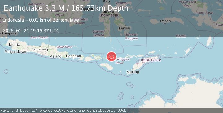
A 3.3 magnitude earthquake struck on Flores Region, Indonesia, at Wed, 21 Jan 2026 19:15:37 GMT. Depth: 165.731766km. Reviewed by BMKG seismologists, this minor quake occurred at a magnitude type of M.
Magnitude
3.3
M
Source
BMKG
Intensity
-
Agency Reports
1 Sources| Source | Magnitude | Depth | Time |
|---|---|---|---|
| BMKGPrimary | 3.3 | 166 km | 5 days ago |
Earthquake Details
AutomaticEvent IDbmg2026bmae
Tsunami PotentialNo
Magnitude TypeM
Nearest Places
- Desa Golo Wontong1.0 km
- Betu1.0 km
- Watuweri1.1 km
- Liangdalo1.9 km
- Golo Pogel2.2 km
Comments
Join the discussion about this event.
Latest Earthquakes
2.6Mag
Minahassa Peninsula, Sulawesi
Time20 hours ago
Depth118.00 km
SourceBMKG (Automatic)
2.8Mag
South of Bali, Indonesia
Time20 hours ago
Depth10.00 km
SourceBMKG (Automatic)
1.7Mag
31 km SE of Denali National Park, Alaska
Time20 hours ago
Depth0.60 km
SourceUSGS (Automatic)
2.2Mag
WESTERN TURKEY
Time20 hours ago
Depth14.90 km
SourceKOERI (Automatic)
2.2Mag
13 km NW of Ferry, Alaska
Time20 hours ago
Depth139.50 km
SourceUSGS (Automatic)
Nearby Earthquakes
2.7Mag
Flores Sea
Time6 days ago
Depth3.32 km
SourceBMKG (Automatic)
2.4Mag
Flores Sea
Time1 day ago
Depth26.09 km
SourceBMKG (Automatic)
2.6Mag
Flores Sea
Time2 days ago
Depth132.04 km
SourceBMKG (Automatic)
2.8Mag
Flores Region, Indonesia
Time4 days ago
Depth174.48 km
SourceBMKG (Automatic)
3.1Mag
Sumba Region, Indonesia
Time1 day ago
Depth7.25 km
SourceBMKG (Automatic)