Earthquake Flores Region, Indonesia
Fri, 23 Jan 2026 07:08:56 GMT
Time4 days ago
Location
-8.2163, 119.9491
Depth
174.5 KM
Event Summary
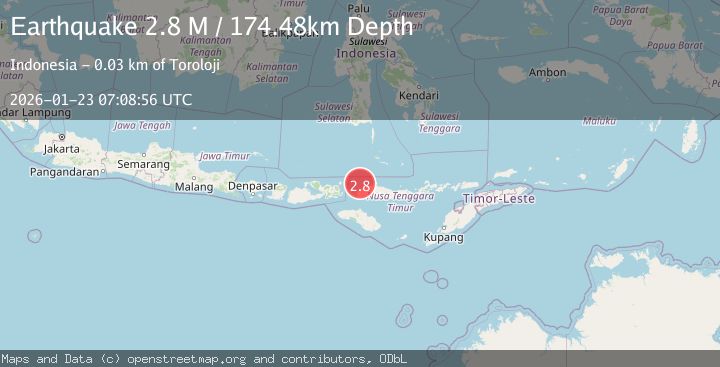
A 2.8 magnitude earthquake struck on Flores Region, Indonesia, at Fri, 23 Jan 2026 07:08:56 GMT. Depth: 174.481232km. Reviewed by BMKG seismologists, this minor quake occurred at a magnitude type of M.
Magnitude
2.8
M
Source
BMKG
Intensity
-
Agency Reports
1 Sources| Source | Magnitude | Depth | Time |
|---|---|---|---|
| BMKGPrimary | 2.8 | 174 km | 4 days ago |
Earthquake Details
AutomaticEvent IDbmg2026botf
Tsunami PotentialNo
Magnitude TypeM
Nearest Places
- Pulau Sababi18.0 km
- Selat Gili Bodo19.5 km
- Toro Seraya Besar19.8 km
- Tanjung Pontianak20.2 km
- Tanjung Kokotuku20.5 km
Comments
Join the discussion about this event.
Latest Earthquakes
3.7Mag
VALPARAISO, CHILE
Time4 minutes ago
Depth27.60 km
SourceCSN (Automatic)
2.0Mag
CENTRAL TURKEY
Time7 minutes ago
Depth23.50 km
SourceKOERI (Automatic)
3.2Mag
OFFSHORE EL SALVADOR
Time8 minutes ago
Depth28.00 km
SourceINET (Automatic)
3.1Mag
South of Java, Indonesia
Time9 minutes ago
Depth5.01 km
SourceBMKG (Automatic)
2.2Mag
Near North Coast of West Papua
Time11 minutes ago
Depth10.00 km
SourceBMKG (Automatic)
Nearby Earthquakes
2.6Mag
FLORES REGION, INDONESIA
Time19 hours ago
Depth153.00 km
SourceBMKG (Automatic)
2.5Mag
Flores Region, Indonesia
Time1 day ago
Depth179.70 km
SourceBMKG (Automatic)
2.7Mag
Flores Region, Indonesia
Time4 days ago
Depth160.88 km
SourceBMKG (Automatic)
2.5Mag
Flores Region, Indonesia
Time6 days ago
Depth147.07 km
SourceBMKG (Automatic)
2.7Mag
Flores Sea
Time5 days ago
Depth3.32 km
SourceBMKG (Automatic)