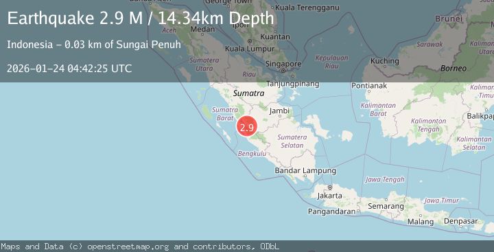
Earthquake Southern Sumatra, Indonesia
Sat, 24 Jan 2026 04:42:25 GMT
Time3 days ago
Location
-2.2693, 101.5207
Depth
14.3 KM
Event Summary
A 2.9 magnitude earthquake struck on Southern Sumatra, Indonesia, at Sat, 24 Jan 2026 04:42:25 GMT. Depth: 14.344776km. Reviewed by BMKG seismologists, this minor quake occurred at a magnitude type of M.
Magnitude
2.9
M
Source
BMKG
Intensity
-
Agency Reports
1 Sources| Source | Magnitude | Depth | Time |
|---|---|---|---|
| BMKGPrimary | 2.9 | 14 km | 3 days ago |
Earthquake Details
AutomaticEvent IDbmg2026bqjx
Tsunami PotentialNo
Magnitude TypeM
Nearest Places
- Lempur Mudik2.3 km
- Danau Langkat2.4 km
- Kelurahan Lempur Tengah2.7 km
- Lempur Tengah2.8 km
- Kota Miang3.5 km
Comments
Join the discussion about this event.
Latest Earthquakes
3.1Mag
South of Java, Indonesia
Time3 minutes ago
Depth5.01 km
SourceBMKG (Automatic)
2.2Mag
Near North Coast of West Papua
Time6 minutes ago
Depth10.00 km
SourceBMKG (Automatic)
1.6Mag
4 km SE of Julian, CA
Time22 minutes ago
Depth10.57 km
SourceUSGS (Automatic)
3.4Mag
BIO-BIO, CHILE
Time24 minutes ago
Depth17.50 km
SourceCSN (Automatic)
2.7Mag
FRANCE
Time30 minutes ago
Depth5.00 km
SourceReNaSS (Automatic)
Nearby Earthquakes
2.5Mag
Southern Sumatra, Indonesia
Time1 day ago
Depth15.39 km
SourceBMKG (Automatic)
2.7Mag
Southern Sumatra, Indonesia
Time3 days ago
Depth129.75 km
SourceBMKG (Automatic)
3.8Mag
Southern Sumatra, Indonesia
Time5 days ago
Depth3.60 km
SourceBMKG (Automatic)
3.9Mag
Southern Sumatra, Indonesia
Time6 days ago
Depth10.00 km
SourceBMKG (Automatic)
3.6Mag
Southern Sumatra, Indonesia
Time3 days ago
Depth11.08 km
SourceBMKG (Automatic)