Earthquake Flores Sea
Sat, 24 Jan 2026 16:43:43 GMT
Time2 days ago
Location
-7.6458, 118.6764
Depth
36.9 KM
Event Summary
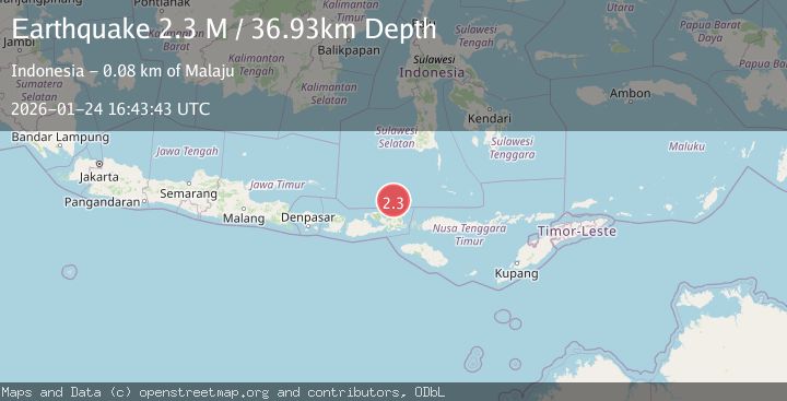
A 2.3 magnitude earthquake struck on Flores Sea, at Sat, 24 Jan 2026 16:43:43 GMT. Depth: 36.934441km. Reviewed by BMKG seismologists, this minor quake occurred at a magnitude type of M.
Magnitude
2.3
M
Source
BMKG
Intensity
-
Agency Reports
1 Sources| Source | Magnitude | Depth | Time |
|---|---|---|---|
| BMKGPrimary | 2.3 | 37 km | 2 days ago |
Earthquake Details
AutomaticEvent IDbmg2026brhr
Tsunami PotentialNo
Magnitude TypeM
Nearest Places
- Pulau Pelokang59.5 km
- Pulau Sarege64.0 km
- Pulau Tingaluang64.1 km
- Pulau Sanogah68.5 km
- Toro Ncia69.8 km
Comments
Join the discussion about this event.
Latest Earthquakes
2.5Mag
Northern Sumatra, Indonesia
Time2 minutes ago
Depth5.00 km
SourceBMKG (Automatic)
2.4Mag
EASTERN TURKEY
Time12 minutes ago
Depth4.30 km
SourceKOERI (Automatic)
0.2Mag
6 km WNW of Cobb, CA
Time15 minutes ago
Depth1.56 km
SourceUSGS (Automatic)
1.6Mag
10 km SW of Furnace Creek, California
Time15 minutes ago
Depth7.46 km
SourceUSGS (Automatic)
1.4Mag
17 km NNE of Indio, CA
Time18 minutes ago
Depth3.80 km
SourceUSGS (Automatic)
Nearby Earthquakes
2.5Mag
Flores Sea
Time1 hour ago
Depth26.93 km
SourceBMKG (Automatic)
2.5Mag
Flores Sea
Time17 hours ago
Depth38.21 km
SourceBMKG (Automatic)
2.5Mag
Flores Sea
Time12 hours ago
Depth21.75 km
SourceBMKG (Automatic)
2.5Mag
Flores Sea
Time4 days ago
Depth25.83 km
SourceBMKG (Automatic)
2.3Mag
Flores Sea
Time5 days ago
Depth29.87 km
SourceBMKG (Automatic)