Earthquake Mindanao, Philippines
Mon, 26 Jan 2026 00:33:42 GMT
Time1 day ago
Location
6.4715, 123.7845
Depth
170.0 KM
Event Summary
A 4.5 magnitude earthquake struck on Mindanao, Philippines, at Mon, 26 Jan 2026 00:33:42 GMT. Depth: 170.008362km. Reviewed by BMKG seismologists, this light quake occurred at a magnitude type of M.
Magnitude
4.5
M
Source
BMKG
Intensity
-
Agency Reports
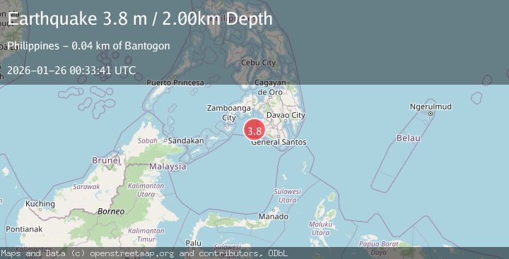
2 Sources| Source | Magnitude | Depth | Time |
|---|---|---|---|
| BMKGPrimary | 4.5 | 170 km | 1 day ago |
| PIVS | 3.8 | 2 km | 1 day ago |
Earthquake Details
AutomaticEvent IDbmg2026btsr
Tsunami PotentialNo
Magnitude TypeM
Nearest Places
- Donaung Shoals23.0 km
- Donauang Island26.3 km
- Basiauang Bay26.9 km
- Nara Point26.9 km
- Point Pitas27.0 km
Comments
Join the discussion about this event.
Latest Earthquakes
3.2Mag
SAN JUAN, ARGENTINA
Time15 hours ago
Depth96.00 km
SourceNSNA (Automatic)
3.3Mag
South of Sumbawa, Indonesia
Time15 hours ago
Depth10.00 km
SourceBMKG (Automatic)
3.7Mag
South of Java, Indonesia
Time15 hours ago
Depth28.43 km
SourceBMKG (Automatic)
2.1Mag
GREATER LOS ANGELES AREA, CALIF.
Time15 hours ago
Depth2.90 km
SourceSCSN (Automatic)
1.8Mag
25 km S of Westbrook, Texas
Time15 hours ago
Depth2.05 km
SourceUSGS (Automatic)
Nearby Earthquakes
3.4Mag
MORO GULF, MINDANAO, PHILIPPINES
Time6 days ago
Depth22.00 km
SourcePIVS (Automatic)
4.2Mag
MORO GULF, MINDANAO, PHILIPPINES
Time6 days ago
Depth10.00 km
SourcePIVS (Automatic)
3.6Mag
MORO GULF, MINDANAO, PHILIPPINES
Time4 days ago
Depth6.00 km
SourcePIVS (Automatic)
3.0Mag
MORO GULF, MINDANAO, PHILIPPINES
Time1 day ago
Depth23.00 km
SourcePIVS (Automatic)
3.2Mag
MORO GULF, MINDANAO, PHILIPPINES
Time6 days ago
Depth14.00 km
SourcePIVS (Automatic)