Earthquake West Papua, Indonesia
Mon, 26 Jan 2026 03:05:41 GMT
Time1 day ago
Location
-2.0286, 138.8553
Depth
73.4 KM
Event Summary
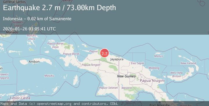
A 2.7 magnitude earthquake struck on West Papua, Indonesia, at Mon, 26 Jan 2026 03:05:41 GMT. Depth: 73.444649km. Reviewed by BMKG seismologists, this minor quake occurred at a magnitude type of M.
Magnitude
2.7
M
Source
BMKG
Intensity
-
Agency Reports
1 Sources| Source | Magnitude | Depth | Time |
|---|---|---|---|
| BMKGPrimary | 2.7 | 73 km | 1 day ago |
Earthquake Details
AutomaticEvent IDbmg2026btxs
Tsunami PotentialNo
Magnitude TypeM
Nearest Places
- Kampung Ebram4.7 km
- Gunung Saksin5.2 km
- Kampung Sewan6.4 km
- Kampung Omte6.5 km
- Gunung Mono6.5 km
Comments
Join the discussion about this event.
Latest Earthquakes
2.0Mag
52 km SSE of Denali National Park, Alaska
Time6 minutes ago
Depth5.00 km
SourceUSGS (Automatic)
1.6Mag
11 km W of Pine Valley, CA
Time8 minutes ago
Depth16.83 km
SourceUSGS (Automatic)
3.5Mag
CRETE, GREECE
Time14 minutes ago
Depth10.00 km
SourceTHE (Automatic)
1.3Mag
86 km NNW of Karluk, Alaska
Time26 minutes ago
Depth5.00 km
SourceUSGS (Automatic)
2.2Mag
WESTERN TURKEY
Time29 minutes ago
Depth11.30 km
SourceAFAD (Automatic)
Nearby Earthquakes
4.4Mag
West Papua, Indonesia
Time6 days ago
Depth23.70 km
SourceBMKG (Automatic)
3.2Mag
Near North Coast of West Papua
Time6 days ago
Depth25.99 km
SourceBMKG (Automatic)
2.5Mag
Near North Coast of West Papua
Time2 days ago
Depth30.91 km
SourceBMKG (Automatic)
2.8Mag
PAPUA, INDONESIA
Time5 days ago
Depth47.00 km
SourceBMKG (Automatic)
3.2Mag
PAPUA, INDONESIA
Time2 days ago
Depth30.00 km
SourceBMKG (Automatic)