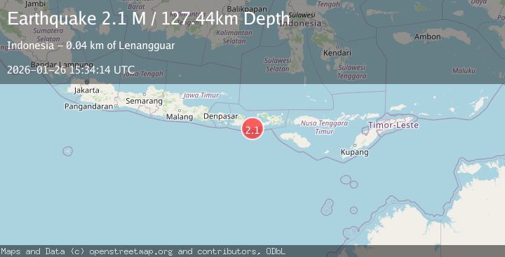
Earthquake Sumbawa Region, Indonesia
Mon, 26 Jan 2026 15:34:14 GMT
Time20 hours ago
Location
-9.0702, 117.2446
Depth
127.4 KM
Event Summary
A 2.1 magnitude earthquake struck on Sumbawa Region, Indonesia, at Mon, 26 Jan 2026 15:34:14 GMT. Depth: 127.443962km. Reviewed by BMKG seismologists, this minor quake occurred at a magnitude type of M.
Magnitude
2.1
M
Source
BMKG
Intensity
-
Agency Reports
1 Sources| Source | Magnitude | Depth | Time |
|---|---|---|---|
| BMKGPrimary | 2.1 | 127 km | 20 hours ago |
Earthquake Details
AutomaticEvent IDbmg2026buwk
Tsunami PotentialNo
Magnitude TypeM
Nearest Places
- Boa Suwir4.6 km
- Brang Suwir4.7 km
- Brang Tenal4.9 km
- Teluk Lampui5.8 km
- Mekarsari6.4 km
Comments
Join the discussion about this event.
Latest Earthquakes
3.8Mag
NEVADA
Time20 hours ago
Depth0.00 km
SourceNN (Automatic)
2.3Mag
WESTERN TURKEY
Time21 hours ago
Depth9.10 km
SourceKOERI (Automatic)
0.8Mag
87 km NNW of Karluk, Alaska
Time21 hours ago
Depth32.30 km
SourceUSGS (Automatic)
2.9Mag
Java, Indonesia
Time21 hours ago
Depth22.77 km
SourceBMKG (Automatic)
2.2Mag
NEVADA
Time21 hours ago
Depth10.60 km
SourceNN (Automatic)
Nearby Earthquakes
2.2Mag
Sumbawa Region, Indonesia
Time23 hours ago
Depth72.67 km
SourceBMKG (Automatic)
2.1Mag
Sumbawa Region, Indonesia
Time3 days ago
Depth10.00 km
SourceBMKG (Automatic)
2.4Mag
Sumbawa Region, Indonesia
Time4 days ago
Depth268.41 km
SourceBMKG (Automatic)
2.6Mag
Sumbawa Region, Indonesia
Time4 days ago
Depth5.67 km
SourceBMKG (Automatic)
2.3Mag
Sumbawa Region, Indonesia
Time5 days ago
Depth10.00 km
SourceBMKG (Automatic)