Earthquake New Guinea, Papua New Guinea
Mon, 26 Jan 2026 21:53:50 GMT
Time2 months ago
Location
-6.3303, 142.0517
Depth
48.7 KM
Event Summary
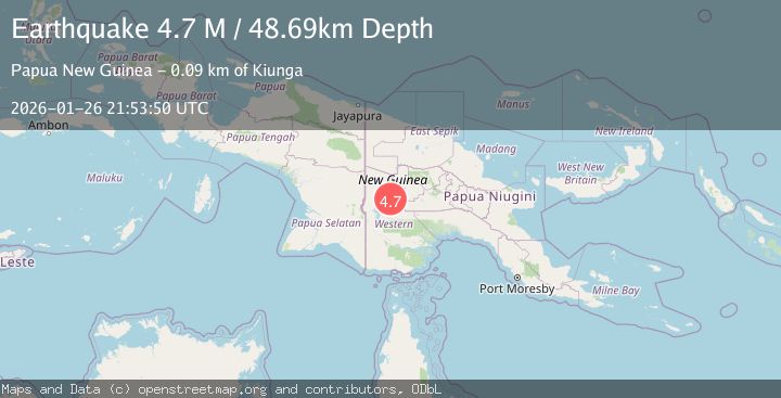
A 4.7 magnitude earthquake struck on New Guinea, Papua New Guinea, at Mon, 26 Jan 2026 21:53:50 GMT. Depth: 48.689556km. Reviewed by BMKG seismologists, this light quake occurred at a magnitude type of M.
Magnitude
4.7
M
Source
BMKG
Intensity
II
Agency Reports
1 Sources| Source | Magnitude | Depth | Time |
|---|---|---|---|
| BMKGPrimary | 4.7 | 49 km | 2 months ago |
Earthquake Details
AutomaticEvent IDbmg2026bvix
QualityS
Tsunami PotentialNo
Magnitude TypeM
Last Update2 months ago
Felt Reports0
Did you feel this earthquake? Report it to help others.
No reports yet
Be the first to report this earthquake!
Latest Earthquakes
Loading...
Nearby Earthquakes
4.6Mag
New Guinea, Papua New Guinea
Time2 weeks ago
Depth10.00 km
SourceBMKG
4.9Mag
New Guinea, Papua New Guinea
Time2 weeks ago
Depth0.00 km
SourceVYT (Automatic)
4.5Mag
New Guinea, Papua New Guinea
Time3 weeks ago
Depth244.44 km
SourceBMKG
5.1Mag
NEW GUINEA, PAPUA NEW GUINEA
Time9 months ago
Depth27.00 km
SourceEMSC (Automatic)
5.1Mag
NEW GUINEA, PAPUA NEW GUINEA
Time3 years ago
Depth10.00 km
SourceEMSC (Automatic)