Earthquake Flores Sea
Thu, 29 Jan 2026 04:46:42 GMT
Time7 hours ago
Location
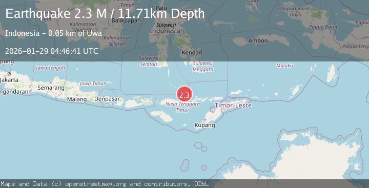
-7.9328, 121.9068
Depth
24.9 KM
Event Summary
A 2.3 magnitude earthquake struck on Flores Sea, at Thu, 29 Jan 2026 04:46:42 GMT. Depth: 24.917589km. Reviewed by BMKG seismologists, this minor quake occurred at a magnitude type of M.
Magnitude
2.3
M
Source
BMKG
Intensity
-
Agency Reports
1 Sources| Source | Magnitude | Depth | Time |
|---|---|---|---|
| BMKGPrimary | 2.3 | 25 km | 7 hours ago |
Earthquake Details
AutomaticEvent IDbmg2026bzno
Tsunami PotentialNo
Magnitude TypeM
Nearest Places
- Pulau Sukun31.2 km
- Desa Samparong31.6 km
- Pasir Layaran42.6 km
- Tanjung Karang44.9 km
- Uwa45.1 km
Comments
Join the discussion about this event.
Latest Earthquakes
0.7Mag
15 km SSE of Mammoth Lakes, CA
Time7 hours ago
Depth8.50 km
SourceUSGS (Automatic)
3.0Mag
EASTERN HONSHU, JAPAN
Time8 hours ago
Depth10.00 km
SourceJMA (Automatic)
1.3Mag
3 km ESE of Lake Henshaw, CA
Time8 hours ago
Depth11.72 km
SourceUSGS (Automatic)
2.9Mag
OFFSHORE COQUIMBO, CHILE
Time8 hours ago
Depth50.10 km
SourceCSN (Automatic)
3.8Mag
ALASKA PENINSULA
Time8 hours ago
Depth60.00 km
SourceNEIC (Automatic)
Nearby Earthquakes
3.1Mag
Flores Region, Indonesia
Time3 days ago
Depth1.78 km
SourceBMKG (Automatic)
2.4Mag
Flores Region, Indonesia
Time6 days ago
Depth21.00 km
SourceBMKG (Automatic)
2.9Mag
Flores Sea
Time4 days ago
Depth36.13 km
SourceBMKG (Automatic)
2.6Mag
Flores Sea
Time1 day ago
Depth21.23 km
SourceBMKG (Automatic)
2.4Mag
Flores Sea
Time3 days ago
Depth26.09 km
SourceBMKG (Automatic)