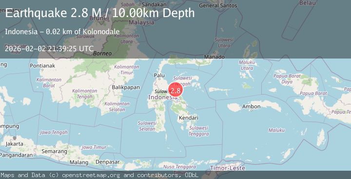
Earthquake Sulawesi, Indonesia
Mon, 02 Feb 2026 21:39:25 GMT
Time1 hour ago
Location
-1.8278, 121.3463
Depth
5.0 KM
Event Summary
A 2.8 magnitude earthquake struck on Sulawesi, Indonesia, at Mon, 02 Feb 2026 21:39:25 GMT. Depth: 5km. Reviewed by BMKG seismologists, this minor quake occurred at a magnitude type of M.
Magnitude
2.8
M
Source
BMKG
Intensity
-
Agency Reports
1 Sources| Source | Magnitude | Depth | Time |
|---|---|---|---|
| BMKGPrimary | 2.8 | 5 km | 1 hour ago |
Earthquake Details
AutomaticEvent IDbmg2026cicz
Tsunami PotentialNo
Magnitude TypeM
Nearest Places
- Teluk Tombayoli1.3 km
- Pulau Dua1.4 km
- Tanjung Kolokima2.7 km
- Tanjung Manu4.1 km
- Waerangu4.4 km
Comments
Join the discussion about this event.
Latest Earthquakes
1.5Mag
5 km SE of San Ramon, CA
Time1 hour ago
Depth6.55 km
SourceUSGS (Automatic)
3.8Mag
Southern Sumatra, Indonesia
Time1 hour ago
Depth10.00 km
SourceBMKG (Automatic)
2.4Mag
West Papua Region, Indonesia
Time1 hour ago
Depth9.36 km
SourceBMKG (Automatic)
4.4Mag
FIJI REGION
Time1 hour ago
Depth493.40 km
SourceNEIC (Automatic)
2.1Mag
Timor Region
Time2 hours ago
Depth11.36 km
SourceBMKG (Automatic)
Nearby Earthquakes
2.0Mag
Sulawesi, Indonesia
Time5 days ago
Depth11.05 km
SourceBMKG (Automatic)
4.4Mag
Sulawesi, Indonesia
Time1 week ago
Depth5.00 km
SourceBMKG (Automatic)
2.5Mag
Sulawesi, Indonesia
Time1 week ago
Depth5.00 km
SourceBMKG (Automatic)
2.1Mag
Sulawesi, Indonesia
Time1 week ago
Depth2.70 km
SourceBMKG (Automatic)
2.4Mag
Sulawesi, Indonesia
Time4 days ago
Depth10.00 km
SourceBMKG (Automatic)