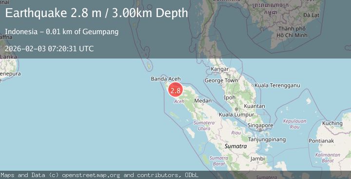
Earthquake Northern Sumatra, Indonesia
Tue, 03 Feb 2026 07:20:31 GMT
Time2 weeks ago
Location
4.9263, 96.2146
Depth
3.0 KM
Event Summary
A 2.8 magnitude earthquake struck on Northern Sumatra, Indonesia, at Tue, 03 Feb 2026 07:20:31 GMT. Depth: 3km. Reviewed by BMKG seismologists, this minor quake occurred at a magnitude type of M.
Magnitude
2.8
M
Source
BMKG
Intensity
-
Agency Reports
1 Sources| Source | Magnitude | Depth | Time |
|---|---|---|---|
| BMKGPrimary | 2.8 | 3 km | 2 weeks ago |
Earthquake Details
AutomaticEvent IDbmg2026ciwd
Tsunami PotentialNo
Magnitude TypeM
Nearest Places
- Lutueng2.5 km
- Gunung Panggade3.1 km
- Krueng Guha4.7 km
- Alue Simpang Lee Jeureungeh5.9 km
- Alue Simpangluko5.9 km
Comments
Join the discussion about this event.
Latest Earthquakes
2.8Mag
Sulawesi, Indonesia
Time2 minutes ago
Depth21.08 km
SourceBMKG
2.1Mag
WESTERN TURKEY
Time6 minutes ago
Depth12.30 km
SourceKOERI (Automatic)
2.2Mag
Alaska Peninsula
Time6 minutes ago
Depth57.74 km
SourceVYT (Automatic)
3.7Mag
WESTERN TURKEY
Time9 minutes ago
Depth13.30 km
SourceKOERI (Automatic)
1.6Mag
27 km ESE of Balmorhea, Texas
Time9 minutes ago
Depth3.56 km
SourceUSGS (Automatic)
Nearby Earthquakes
3.0Mag
NORTHERN SUMATRA, INDONESIA
Time3 years ago
Depth12.00 km
SourceDJA (Automatic)
3.0Mag
NORTHERN SUMATRA, INDONESIA
Time3 years ago
Depth10.00 km
SourceDJA (Automatic)
5.3Mag
NORTHERN SUMATRA, INDONESIA
Time13 years ago
Depth15.00 km
SourceEMSC (Automatic)
2.2Mag
Northern Sumatra, Indonesia
Time1 day ago
Depth10.98 km
SourceBMKG
5.1Mag
NORTHERN SUMATRA, INDONESIA
Time19 years ago
Depth40.00 km
SourceEMSC (Automatic)