Earthquake Timor Region
Tue, 03 Feb 2026 17:14:54 GMT
Time23 hours ago
Location
-8.2444, 125.0629
Depth
22.8 KM
Event Summary
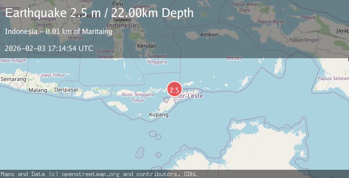
A 2.5 magnitude earthquake struck on Timor Region, at Tue, 03 Feb 2026 17:14:54 GMT. Depth: 22.798876km. Reviewed by BMKG seismologists, this minor quake occurred at a magnitude type of M.
Magnitude
2.5
M
Source
BMKG
Intensity
-
Agency Reports
1 Sources| Source | Magnitude | Depth | Time |
|---|---|---|---|
| BMKGPrimary | 2.5 | 23 km | 23 hours ago |
Earthquake Details
AutomaticEvent IDbmg2026cjpt
Tsunami PotentialNo
Magnitude TypeM
Nearest Places
- Dola Suariki1.0 km
- Dola Tamasa2.8 km
- Ireaku Koyakoya2.9 km
- Dola Salimana3.0 km
- Desa Kolana Selatan3.2 km
Comments
Join the discussion about this event.
Latest Earthquakes
2.1Mag
Seram, Indonesia
Time23 hours ago
Depth3.92 km
SourceBMKG (Automatic)
2.5Mag
PYRENEES
Time23 hours ago
Depth5.00 km
SourceReNaSS (Automatic)
2.8Mag
SAN FRANCISCO BAY AREA, CALIF.
Time23 hours ago
Depth7.70 km
SourceNC (Automatic)
2.1Mag
Sumbawa Region, Indonesia
Time1 day ago
Depth92.82 km
SourceBMKG (Automatic)
3.2Mag
Flores Sea
Time1 day ago
Depth22.19 km
SourceBMKG (Automatic)
Nearby Earthquakes
2.0Mag
Timor Region
Time1 week ago
Depth21.90 km
SourceBMKG (Automatic)
2.1Mag
Timor Region
Time1 day ago
Depth11.36 km
SourceBMKG (Automatic)
2.8Mag
Timor Region
Time6 days ago
Depth10.00 km
SourceBMKG (Automatic)
3.2Mag
KEPULAUAN ALOR, INDONESIA
Time1 week ago
Depth208.00 km
SourceBMKG (Automatic)
2.7Mag
Timor Region
Time1 week ago
Depth16.38 km
SourceBMKG (Automatic)