Earthquake Sumba Region, Indonesia
Sat, 07 Feb 2026 08:42:50 GMT
Time1 hour ago
Location
-9.5099, 119.0920
Depth
19.7 KM
Event Summary
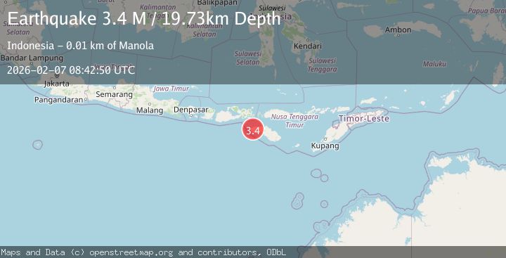
A 3.4 magnitude earthquake struck on Sumba Region, Indonesia, at Sat, 07 Feb 2026 08:42:50 GMT. Depth: 19.728445km. Reviewed by BMKG seismologists, this minor quake occurred at a magnitude type of M.
Magnitude
3.4
M
Source
BMKG
Intensity
-
Agency Reports
1 Sources| Source | Magnitude | Depth | Time |
|---|---|---|---|
| BMKGPrimary | 3.4 | 20 km | 1 hour ago |
Earthquake Details
AutomaticEvent IDbmg2026cqgw
Tsunami PotentialNo
Magnitude TypeM
Nearest Places
- Desa Waiholo0.5 km
- Malimbi0.6 km
- Galluhanggak0.8 km
- Bondokahole0.8 km
- Waimoto0.8 km
Comments
Join the discussion about this event.
Latest Earthquakes
3.4Mag
CENTRAL ALASKA
Time7 minutes ago
Depth131.20 km
SourceAK (Automatic)
3.0Mag
OFFSHORE VALPARAISO, CHILE
Time14 minutes ago
Depth10.00 km
SourceCSN (Automatic)
2.8Mag
Borneo
Time18 minutes ago
Depth4.69 km
SourceBMKG (Automatic)
1.5Mag
22 km ENE of San Lucas, CA
Time20 minutes ago
Depth5.20 km
SourceUSGS (Automatic)
2.5Mag
72 km SE of Kokhanok, Alaska
Time24 minutes ago
Depth113.70 km
SourceUSGS (Automatic)
Nearby Earthquakes
3.5Mag
Sumba Region, Indonesia
Time1 week ago
Depth7.78 km
SourceBMKG (Automatic)
2.2Mag
Sumba Region, Indonesia
Time4 days ago
Depth10.00 km
SourceBMKG (Automatic)
2.4Mag
Sumba Region, Indonesia
Time1 week ago
Depth68.13 km
SourceBMKG (Automatic)
2.3Mag
Sumba Region, Indonesia
Time1 week ago
Depth8.14 km
SourceBMKG (Automatic)
2.3Mag
Sumba Region, Indonesia
Time1 week ago
Depth63.48 km
SourceBMKG (Automatic)