Earthquake Northern Sumatra, Indonesia
Sun, 08 Feb 2026 15:12:40 GMT
Time1 week ago
Location
3.0717, 96.3687
Depth
4.7 KM
Event Summary
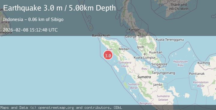
A 3.0 magnitude earthquake struck on Northern Sumatra, Indonesia, at Sun, 08 Feb 2026 15:12:40 GMT. Depth: 4.692765km. Reviewed by BMKG seismologists, this minor quake occurred at a magnitude type of M.
Magnitude
3.0
M
Source
BMKG
Intensity
-
Agency Reports
1 Sources| Source | Magnitude | Depth | Time |
|---|---|---|---|
| BMKGPrimary | 3.0 | 5 km | 1 week ago |
Earthquake Details
AutomaticEvent IDbmg2026cspf
Tsunami PotentialNo
Magnitude TypeM
Nearest Places
- Karang Dog41.8 km
- Ujung Marademan45.8 km
- Ujung Siango46.0 km
- Pulau Balu46.6 km
- Gampong Pulau Siumat46.8 km
Comments
Join the discussion about this event.
Latest Earthquakes
4.5Mag
North of Halmahera, Indonesia
Time3 minutes ago
Depth10.00 km
SourceBMKG
3.1Mag
Bali Region, Indonesia
Time9 minutes ago
Depth19.14 km
SourceBMKG
2.7Mag
Coquimbo, Chile
Time11 minutes ago
Depth14.16 km
SourceVYT (Automatic)
1.7Mag
Southeastern Alaska
Time13 minutes ago
Depth5.98 km
SourceVYT (Automatic)
2.1Mag
Tarapaca, Chile
Time14 minutes ago
Depth110.35 km
SourceVYT (Automatic)
Nearby Earthquakes
3.0Mag
NORTHERN SUMATRA, INDONESIA
Time5 years ago
Depth10.00 km
SourceDJA (Automatic)
5.1Mag
NORTHERN SUMATRA, INDONESIA
Time18 years ago
Depth43.00 km
SourceEMSC (Automatic)
5.4Mag
NORTHERN SUMATRA, INDONESIA
Time20 years ago
Depth10.00 km
SourceEMSC (Automatic)
5.5Mag
NORTHERN SUMATRA, INDONESIA
Time20 years ago
Depth60.00 km
SourceEMSC (Automatic)
5.2Mag
NORTHERN SUMATRA, INDONESIA
Time20 years ago
Depth33.00 km
SourceEMSC (Automatic)