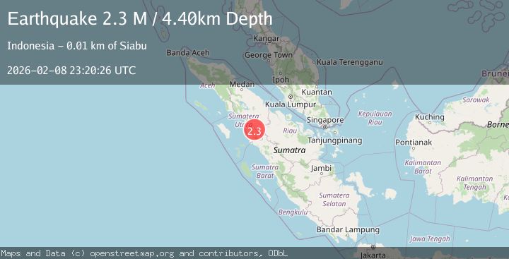
Earthquake Northern Sumatra, Indonesia
Sun, 08 Feb 2026 23:20:26 GMT
Time5 hours ago
Location
1.1277, 99.4852
Depth
4.4 KM
Event Summary
A 2.3 magnitude earthquake struck on Northern Sumatra, Indonesia, at Sun, 08 Feb 2026 23:20:26 GMT. Depth: 4.401856km. Reviewed by BMKG seismologists, this minor quake occurred at a magnitude type of M.
Magnitude
2.3
M
Source
BMKG
Intensity
-
Agency Reports
1 Sources| Source | Magnitude | Depth | Time |
|---|---|---|---|
| BMKGPrimary | 2.3 | 4 km | 5 hours ago |
Earthquake Details
AutomaticEvent IDbmg2026ctfi
Tsunami PotentialNo
Magnitude TypeM
Nearest Places
- Dolok Soporuang0.8 km
- Dolok Gonting Batu1.5 km
- Desa Sihepeng Lima2.3 km
- Desa Sihepeng2.6 km
- Desa Sihepeng Opat2.8 km
Comments
Join the discussion about this event.
Latest Earthquakes
4.1Mag
ANTOFAGASTA, CHILE
Time6 hours ago
Depth112.90 km
SourceCSN (Automatic)
3.1Mag
MENDOZA, ARGENTINA
Time6 hours ago
Depth10.00 km
SourceNSNA (Automatic)
3.2Mag
OFF COAST OF COQUIMBO, CHILE
Time6 hours ago
Depth11.50 km
SourceCSN (Automatic)
1.2Mag
38 km WSW of Ackerly, Texas
Time6 hours ago
Depth5.71 km
SourceUSGS (Automatic)
1.0Mag
1 km NE of The Geysers, CA
Time6 hours ago
Depth-0.62 km
SourceUSGS (Automatic)
Nearby Earthquakes
3.2Mag
Northern Sumatra, Indonesia
Time2 weeks ago
Depth8.24 km
SourceBMKG (Automatic)
3.2Mag
Northern Sumatra, Indonesia
Time1 week ago
Depth4.64 km
SourceBMKG (Automatic)
2.2Mag
Northern Sumatra, Indonesia
Time1 week ago
Depth99.84 km
SourceBMKG (Automatic)
2.7Mag
NORTHERN SUMATRA, INDONESIA
Time1 week ago
Depth130.00 km
SourceBMKG (Automatic)
2.6Mag
Northern Sumatra, Indonesia
Time2 weeks ago
Depth8.35 km
SourceBMKG (Automatic)