Earthquake Near North Coast of West Papua
Tue, 10 Feb 2026 15:32:23 GMT
Time1 week ago
Location
-1.9523, 139.9475
Depth
10.0 KM
Event Summary
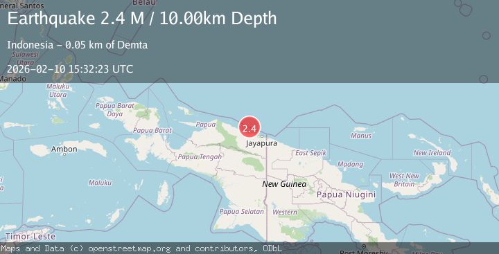
A 2.4 magnitude earthquake struck on Near North Coast of West Papua, at Tue, 10 Feb 2026 15:32:23 GMT. Depth: 10km. Reviewed by BMKG seismologists, this minor quake occurred at a magnitude type of M.
Magnitude
2.4
M
Source
BMKG
Intensity
-
Agency Reports
1 Sources| Source | Magnitude | Depth | Time |
|---|---|---|---|
| BMKGPrimary | 2.4 | 10 km | 1 week ago |
Earthquake Details
ManualEvent IDbmg2026cwgw
Tsunami PotentialNo
Magnitude TypeM
Nearest Places
- Tarfia42.2 km
- Teluk Walckenaer43.2 km
- Tanjung Kamadara45.0 km
- Moaif45.7 km
- Sungai Sermo46.0 km
Comments
Join the discussion about this event.
Latest Earthquakes
2.5Mag
Minahasa, Sulawesi, Indonesia
Time1 minute ago
Depth3.05 km
SourceVYT (Automatic)
2.6Mag
Antofagasta, Chile
Time1 minute ago
Depth125.12 km
SourceVYT (Automatic)
0.8Mag
7 km NW of The Geysers, CA
Time5 minutes ago
Depth1.32 km
SourceUSGS (Automatic)
2.5Mag
San Juan, Argentina
Time10 minutes ago
Depth363.53 km
SourceVYT (Automatic)
2.5Mag
Java, Indonesia
Time10 minutes ago
Depth115.43 km
SourceBMKG
Nearby Earthquakes
2.8Mag
West Papua Region, Indonesia
Time5 days ago
Depth10.00 km
SourceBMKG
2.8Mag
West Papua Region, Indonesia
Time5 days ago
Depth10.00 km
SourceBMKG
2.3Mag
Near North Coast of West Papua
Time2 weeks ago
Depth21.38 km
SourceBMKG (Automatic)
4.0Mag
NEAR N COAST OF PAPUA, INDONESIA
Time6 years ago
Depth10.00 km
SourceDJA (Automatic)
4.0Mag
NEAR N COAST OF PAPUA, INDONESIA
Time8 months ago
Depth10.00 km
SourceBMKG (Automatic)