Earthquake West Papua Region, Indonesia
Fri, 13 Feb 2026 21:47:33 GMT
Time5 days ago
Location
-1.9452, 140.0423
Depth
10.0 KM
Event Summary
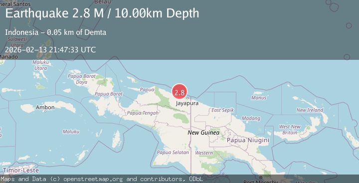
A 2.8 magnitude earthquake struck on West Papua Region, Indonesia, at Fri, 13 Feb 2026 21:47:33 GMT. Depth: 10km. Reviewed by BMKG seismologists, this minor quake occurred at a magnitude type of M.
Magnitude
2.8
M
Source
BMKG
Intensity
-
Agency Reports
1 Sources| Source | Magnitude | Depth | Time |
|---|---|---|---|
| BMKGPrimary | 2.8 | 10 km | 5 days ago |
Earthquake Details
ManualEvent IDbmg2026dcft
Tsunami PotentialNo
Magnitude TypeM
Nearest Places
- Tarfia40.0 km
- Tanjung Kamadara42.5 km
- Tanjung Korongwan43.5 km
- Teluk Matterer44.0 km
- Pulau Besar44.8 km
Comments
Join the discussion about this event.
Latest Earthquakes
1.4Mag
EASTERN TURKEY
Time6 minutes ago
Depth6.80 km
SourceAFAD (Automatic)
1.7Mag
northern Alaska
Time7 minutes ago
Depth4.64 km
SourceVYT (Automatic)
1.2Mag
5 km WNW of The Geysers, CA
Time12 minutes ago
Depth3.19 km
SourceUSGS (Automatic)
3.4Mag
Sulawesi, Indonesia
Time16 minutes ago
Depth27.95 km
SourceVYT (Automatic)
1.6Mag
Central Alaska
Time17 minutes ago
Depth18.07 km
SourceVYT (Automatic)
Nearby Earthquakes
2.8Mag
West Papua Region, Indonesia
Time5 days ago
Depth10.00 km
SourceBMKG
2.4Mag
Near North Coast of West Papua
Time1 week ago
Depth10.00 km
SourceBMKG
4.0Mag
NEAR N COAST OF PAPUA, INDONESIA
Time8 months ago
Depth10.00 km
SourceBMKG (Automatic)
2.3Mag
Near North Coast of West Papua
Time2 weeks ago
Depth21.38 km
SourceBMKG (Automatic)
3.0Mag
NEAR N COAST OF PAPUA, INDONESIA
Time3 months ago
Depth10.00 km
SourceBMKG (Automatic)