Earthquake Northern Molucca Sea
Thu, 12 Feb 2026 07:08:32 GMT
Time1 week ago
Location
0.8469, 125.3838
Depth
63.9 KM
Event Summary
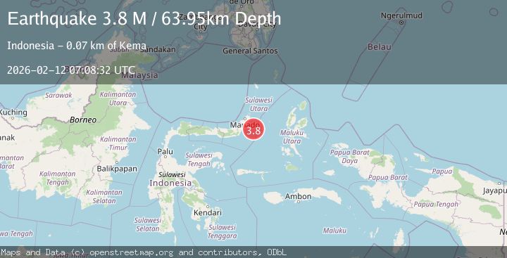
A 3.8 magnitude earthquake struck on Northern Molucca Sea, at Thu, 12 Feb 2026 07:08:32 GMT. Depth: 63.945759km. Reviewed by BMKG seismologists, this minor quake occurred at a magnitude type of M.
Magnitude
3.8
M
Source
BMKG
Intensity
-
Agency Reports
1 Sources| Source | Magnitude | Depth | Time |
|---|---|---|---|
| BMKGPrimary | 3.8 | 64 km | 1 week ago |
Earthquake Details
ManualEvent IDbmg2026czhg
Tsunami PotentialNo
Magnitude TypeM
Nearest Places
- Pulau Pakolor50.3 km
- Sosoan Kinamang51.8 km
- Parumis51.8 km
- Sosoan Tarandi51.9 km
- Tanjung Atep51.9 km
Comments
Join the discussion about this event.
Latest Earthquakes
5.0Mag
Fox Islands, Aleutian Islands, Alaska
Time5 minutes ago
Depth0.00 km
SourceVYT (Automatic)
3.4Mag
southern Peru
Time8 minutes ago
Depth204.47 km
SourceVYT (Automatic)
2.1Mag
SAN FRANCISCO BAY AREA, CALIF.
Time11 minutes ago
Depth6.40 km
SourceNC (Automatic)
2.4Mag
Fox Islands, Aleutian Islands, Alaska
Time11 minutes ago
Depth44.43 km
SourceVYT (Automatic)
2.4Mag
British Columbia, Canada
Time11 minutes ago
Depth3.91 km
SourceVYT (Automatic)
Nearby Earthquakes
5.0Mag
MOLUCCA SEA
Time7 years ago
Depth80.00 km
SourceEMSC (Automatic)
5.1Mag
MOLUCCA SEA
Time19 years ago
Depth118.00 km
SourceEMSC (Automatic)
5.0Mag
MOLUCCA SEA
Time8 years ago
Depth91.00 km
SourceEMSC (Automatic)
3.8Mag
Northern Molucca Sea
Time1 week ago
Depth53.52 km
SourceBMKG
5.1Mag
MOLUCCA SEA
Time11 years ago
Depth80.00 km
SourceEMSC (Automatic)