Earthquake West Papua Region, Indonesia
Thu, 12 Feb 2026 18:51:11 GMT
Time5 days ago
Location
-0.4755, 132.8008
Depth
10.0 KM
Event Summary
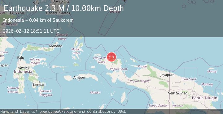
A 2.3 magnitude earthquake struck on West Papua Region, Indonesia, at Thu, 12 Feb 2026 18:51:11 GMT. Depth: 10km. Reviewed by BMKG seismologists, this minor quake occurred at a magnitude type of M.
Magnitude
2.3
M
Source
BMKG
Intensity
-
Agency Reports
1 Sources| Source | Magnitude | Depth | Time |
|---|---|---|---|
| BMKGPrimary | 2.3 | 10 km | 5 days ago |
Earthquake Details
ManualEvent IDbmg2026dael
Tsunami PotentialNo
Magnitude TypeM
Nearest Places
- Distrik Abun3.3 km
- Kampung Wau5.2 km
- Sungai Wermon6.4 km
- Tanjung Wermon8.3 km
- Kampung Weyaf8.6 km
Comments
Join the discussion about this event.
Latest Earthquakes
2.1Mag
WESTERN TURKEY
Time5 minutes ago
Depth12.30 km
SourceKOERI (Automatic)
2.2Mag
Alaska Peninsula
Time5 minutes ago
Depth57.74 km
SourceVYT (Automatic)
3.7Mag
WESTERN TURKEY
Time8 minutes ago
Depth13.30 km
SourceKOERI (Automatic)
1.6Mag
27 km ESE of Balmorhea, Texas
Time8 minutes ago
Depth3.56 km
SourceUSGS (Automatic)
1.6Mag
Southern Alaska
Time9 minutes ago
Depth22.22 km
SourceVYT (Automatic)
Nearby Earthquakes
5.0Mag
NEAR N COAST OF PAPUA, INDONESIA
Time17 years ago
Depth40.00 km
SourceEMSC (Automatic)
5.3Mag
NEAR N COAST OF PAPUA, INDONESIA
Time15 years ago
Depth10.00 km
SourceEMSC (Automatic)
4.0Mag
NEAR N COAST OF PAPUA, INDONESIA
Time2 years ago
Depth10.00 km
SourceDJA (Automatic)
5.4Mag
NEAR N COAST OF PAPUA, INDONESIA
Time17 years ago
Depth54.00 km
SourceEMSC (Automatic)
3.0Mag
NEAR N COAST OF PAPUA, INDONESIA
Time4 years ago
Depth10.00 km
SourceDJA (Automatic)