Earthquake NEAR N COAST OF PAPUA, INDONESIA
Sat, 22 Jan 2011 13:21:25 GMT
Time15 years ago
Location
-0.4000, 132.7700
Depth
10.0 KM
Event Summary
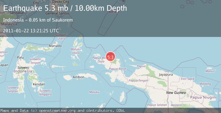
A 5.3 magnitude earthquake struck on NEAR N COAST OF PAPUA, INDONESIA, at Sat, 22 Jan 2011 13:21:25 GMT. Depth: 10km. Reviewed by EMSC seismologists, this moderate quake occurred at a magnitude type of mb.
Magnitude
5.3
mb
Source
EMSC
Intensity
-
Agency Reports
1 Sources| Source | Magnitude | Depth | Time |
|---|---|---|---|
| EMSCPrimary | 5.3 | 10 km | 15 years ago |
Earthquake Details
AutomaticEvent IDemsc_EMSC_20110122_0000040
Tsunami PotentialNo
Magnitude Typemb
Nearest Places
- Tanjung Wermon1.6 km
- Sungai Wermon3.8 km
- Tanjung Saukorem6.7 km
- Tanjung Waios7.0 km
- Kampung Wau8.0 km
Comments
Join the discussion about this event.
Latest Earthquakes
1.7Mag
western Texas
Time4 minutes ago
Depth3.42 km
SourceVYT (Automatic)
3.5Mag
Seram, Indonesia
Time6 minutes ago
Depth0.00 km
SourceVYT (Automatic)
1.6Mag
54 km WNW of Toyah, Texas
Time11 minutes ago
Depth0.00 km
SourceUSGS (Automatic)
2.2Mag
West Papua Region, Indonesia
Time13 minutes ago
Depth26.69 km
SourceBMKG
1.2Mag
WESTERN TURKEY
Time14 minutes ago
Depth7.00 km
SourceAFAD (Automatic)
Nearby Earthquakes
3.0Mag
NEAR N COAST OF PAPUA, INDONESIA
Time4 years ago
Depth10.00 km
SourceDJA (Automatic)
5.4Mag
NEAR N COAST OF PAPUA, INDONESIA
Time17 years ago
Depth54.00 km
SourceEMSC (Automatic)
5.7Mag
NEAR N COAST OF PAPUA, INDONESIA
Time14 years ago
Depth15.00 km
SourceEMSC (Automatic)
4.0Mag
NEAR N COAST OF PAPUA, INDONESIA
Time2 years ago
Depth10.00 km
SourceDJA (Automatic)
2.3Mag
West Papua Region, Indonesia
Time5 days ago
Depth10.00 km
SourceBMKG