Earthquake Flores Region, Indonesia
Thu, 12 Feb 2026 20:19:26 GMT
Time6 days ago
Location
-8.8583, 120.4627
Depth
111.1 KM
Event Summary
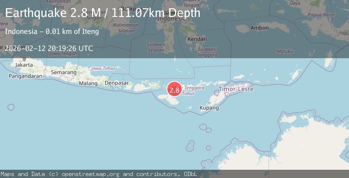
A 2.8 magnitude earthquake struck on Flores Region, Indonesia, at Thu, 12 Feb 2026 20:19:26 GMT. Depth: 111.070488km. Reviewed by BMKG seismologists, this minor quake occurred at a magnitude type of M.
Magnitude
2.8
M
Source
BMKG
Intensity
-
Agency Reports
1 Sources| Source | Magnitude | Depth | Time |
|---|---|---|---|
| BMKGPrimary | 2.8 | 111 km | 6 days ago |
Earthquake Details
ManualEvent IDbmg2026dahj
Tsunami PotentialNo
Magnitude TypeM
Nearest Places
- Teluk Kuse4.5 km
- Tanjung Watulajar4.5 km
- Wae Belang4.6 km
- Wae Nanas4.6 km
- Wae Tembang4.6 km
Comments
Join the discussion about this event.
Latest Earthquakes
3.7Mag
Tarapaca, Chile
Time2 minutes ago
Depth86.67 km
SourceVYT (Automatic)
2.5Mag
Ceram Sea
Time4 minutes ago
Depth3.27 km
SourceBMKG
2.1Mag
Halmahera, Indonesia
Time7 minutes ago
Depth4.45 km
SourceBMKG
3.4Mag
Talaud Islands, Indonesia
Time10 minutes ago
Depth98.99 km
SourceBMKG
2.1Mag
Flores Region, Indonesia
Time11 minutes ago
Depth165.90 km
SourceBMKG
Nearby Earthquakes
3.0Mag
FLORES REGION, INDONESIA
Time5 years ago
Depth102.00 km
SourceDJA (Automatic)
4.0Mag
FLORES REGION, INDONESIA
Time6 years ago
Depth116.00 km
SourceDJA (Automatic)
3.0Mag
FLORES REGION, INDONESIA
Time2 years ago
Depth117.00 km
SourceBMKG (Automatic)
3.1Mag
Sumba Region, Indonesia
Time3 weeks ago
Depth7.25 km
SourceBMKG (Automatic)
3.0Mag
FLORES REGION, INDONESIA
Time1 year ago
Depth10.00 km
SourceBMKG (Automatic)