Earthquake West Papua, Indonesia
Fri, 13 Feb 2026 11:46:44 GMT
Time6 days ago
Location
-2.2161, 138.6991
Depth
10.0 KM
Event Summary
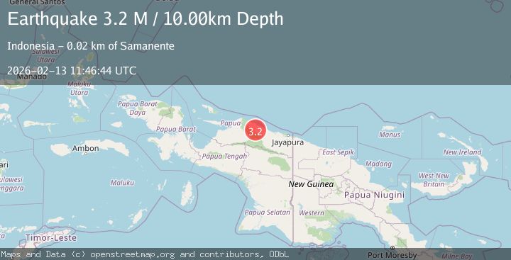
A 3.2 magnitude earthquake struck on West Papua, Indonesia, at Fri, 13 Feb 2026 11:46:44 GMT. Depth: 10km. Reviewed by BMKG seismologists, this minor quake occurred at a magnitude type of M.
Magnitude
3.2
M
Source
BMKG
Intensity
-
Agency Reports
1 Sources| Source | Magnitude | Depth | Time |
|---|---|---|---|
| BMKGPrimary | 3.2 | 10 km | 6 days ago |
Earthquake Details
ManualEvent IDbmg2026dbly
Tsunami PotentialNo
Magnitude TypeM
Nearest Places
- Kampung Safron Tane4.6 km
- Kebun8.1 km
- Gowafjan8.5 km
- Safrontani9.7 km
- Vuabudjernah10.1 km
Comments
Join the discussion about this event.
Latest Earthquakes
1.9Mag
Southeastern Alaska
Time2 minutes ago
Depth0.00 km
SourceVYT (Automatic)
3.4Mag
western Texas
Time4 minutes ago
Depth2.32 km
SourceVYT (Automatic)
2.4Mag
FRANCE
Time6 minutes ago
Depth5.00 km
SourceReNaSS (Automatic)
1.3Mag
Southern Alaska
Time9 minutes ago
Depth0.00 km
SourceVYT (Automatic)
1.7Mag
Kenai Peninsula, Alaska
Time13 minutes ago
Depth2.08 km
SourceVYT (Automatic)
Nearby Earthquakes
5.1Mag
PAPUA, INDONESIA
Time12 years ago
Depth10.00 km
SourceEMSC (Automatic)
3.0Mag
PAPUA, INDONESIA
Time4 months ago
Depth10.00 km
SourceBMKG (Automatic)
3.0Mag
PAPUA, INDONESIA
Time3 months ago
Depth10.00 km
SourceBMKG (Automatic)
5.7Mag
PAPUA, INDONESIA
Time14 years ago
Depth20.00 km
SourceEMSC (Automatic)
4.5Mag
West Papua, Indonesia
Time0 months ago
Depth23.70 km
SourceBMKG (Automatic)