Earthquake North of Halmahera, Indonesia
Fri, 13 Feb 2026 15:23:26 GMT
Time4 days ago
Location
4.1924, 128.3263
Depth
47.1 KM
Event Summary
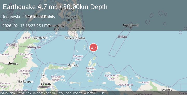
A 4.7 magnitude earthquake struck on North of Halmahera, Indonesia, at Fri, 13 Feb 2026 15:23:26 GMT. Depth: 47.14867km. Reviewed by BMKG seismologists, this light quake occurred at a magnitude type of M.
Magnitude
4.7
M
Source
BMKG
Intensity
-
Agency Reports
2 Sources| Source | Magnitude | Depth | Time |
|---|---|---|---|
| BMKGPrimary | 4.7 | 20 km | 4 days ago |
| EMSC | 4.7 | 50 km | 4 days ago |
Earthquake Details
ManualEvent IDbmg2026dbtc
Tsunami PotentialNo
Magnitude TypeM
Nearest Places
- Snellius Ridge42.0 km
- Talaud Trough103.1 km
- Pulau Karis135.1 km
- Morotai Basin137.4 km
- Pulau Kakorotan138.1 km
Comments
Join the discussion about this event.
Latest Earthquakes
2.1Mag
WESTERN TURKEY
Time5 minutes ago
Depth12.30 km
SourceKOERI (Automatic)
2.2Mag
Alaska Peninsula
Time5 minutes ago
Depth57.74 km
SourceVYT (Automatic)
3.7Mag
WESTERN TURKEY
Time8 minutes ago
Depth13.30 km
SourceKOERI (Automatic)
1.6Mag
27 km ESE of Balmorhea, Texas
Time8 minutes ago
Depth3.56 km
SourceUSGS (Automatic)
1.6Mag
Southern Alaska
Time9 minutes ago
Depth22.22 km
SourceVYT (Automatic)
Nearby Earthquakes
4.0Mag
North of Halmahera, Indonesia
Time4 days ago
Depth139.41 km
SourceBMKG
3.9Mag
North of Halmahera, Indonesia
Time4 days ago
Depth10.00 km
SourceBMKG
4.0Mag
North of Halmahera, Indonesia
Time3 days ago
Depth109.56 km
SourceBMKG
4.7Mag
North of Halmahera, Indonesia
Time5 days ago
Depth10.00 km
SourceBMKG
3.7Mag
NORTH OF HALMAHERA, INDONESIA
Time4 days ago
Depth120.00 km
SourceBMKG (Automatic)