Earthquake Sunda Strait, Indonesia
Sat, 14 Feb 2026 11:00:54 GMT
Time5 days ago
Location
-6.6110, 104.1382
Depth
7.1 KM
Event Summary
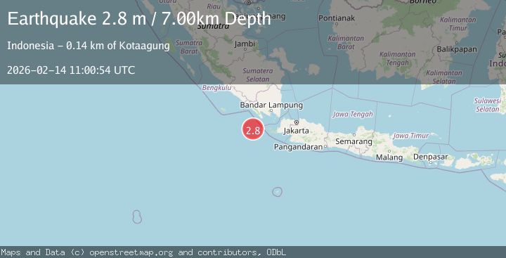
A 2.8 magnitude earthquake struck on Sunda Strait, Indonesia, at Sat, 14 Feb 2026 11:00:54 GMT. Depth: 7.111354km. Reviewed by BMKG seismologists, this minor quake occurred at a magnitude type of M.
Magnitude
2.8
M
Source
BMKG
Intensity
-
Agency Reports
1 Sources| Source | Magnitude | Depth | Time |
|---|---|---|---|
| BMKGPrimary | 2.8 | 7 km | 5 days ago |
Earthquake Details
ManualEvent IDbmg2026ddfy
Tsunami PotentialNo
Magnitude TypeM
Nearest Places
- Tanjung Cuku Balimbing45.0 km
- Enggano Basin80.3 km
- Pulau Betuah86.7 km
- Ujung Saleman89.2 km
- Belimbing90.2 km
Comments
Join the discussion about this event.
Latest Earthquakes
2.9Mag
Seram, Indonesia
Time8 minutes ago
Depth15.78 km
SourceBMKG
2.5Mag
Java, Indonesia
Time9 minutes ago
Depth115.38 km
SourceBMKG
1.4Mag
7 km NW of The Geysers, CA
Time13 minutes ago
Depth1.65 km
SourceUSGS (Automatic)
1.1Mag
7 km NE of San Jacinto, CA
Time17 minutes ago
Depth16.11 km
SourceUSGS (Automatic)
1.4Mag
CENTRAL TURKEY
Time24 minutes ago
Depth7.00 km
SourceAFAD (Automatic)
Nearby Earthquakes
3.0Mag
SUNDA STRAIT, INDONESIA
Time5 years ago
Depth10.00 km
SourceDJA (Automatic)
2.5Mag
Sunda Strait, Indonesia
Time2 weeks ago
Depth6.74 km
SourceBMKG (Automatic)
5.1Mag
SUNDA STRAIT, INDONESIA
Time18 years ago
Depth25.00 km
SourceEMSC (Automatic)
3.0Mag
SUNDA STRAIT, INDONESIA
Time3 years ago
Depth34.00 km
SourceDJA (Automatic)
5.2Mag
SOUTHWEST OF SUMATRA, INDONESIA
Time1 year ago
Depth40.00 km
SourceEMSC (Automatic)