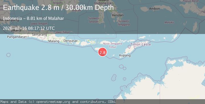
Earthquake Sumba Region, Indonesia
Mon, 16 Feb 2026 08:17:12 GMT
Time2 days ago
Location
-10.0396, 120.1602
Depth
30.0 KM
Event Summary
A 2.8 magnitude earthquake struck on Sumba Region, Indonesia, at Mon, 16 Feb 2026 08:17:12 GMT. Depth: 29.999464km. Reviewed by BMKG seismologists, this minor quake occurred at a magnitude type of M.
Magnitude
2.8
M
Source
BMKG
Intensity
-
Agency Reports
1 Sources| Source | Magnitude | Depth | Time |
|---|---|---|---|
| BMKGPrimary | 2.8 | 30 km | 2 days ago |
Earthquake Details
ManualEvent IDbmg2026dgro
Tsunami PotentialNo
Magnitude TypeM
Nearest Places
- Anduhau0.8 km
- Palindi Halawa1.4 km
- Desa Mahaniwa1.8 km
- Palindi Putuktana2.0 km
- Kiriwangga2.2 km
Comments
Join the discussion about this event.
Latest Earthquakes
1.1Mag
33 km SSE of Glacier View, Alaska
Time1 hour ago
Depth20.20 km
SourceUSGS (Automatic)
1.8Mag
50 km W of Mentone, Texas
Time1 hour ago
Depth3.75 km
SourceUSGS (Automatic)
0.9Mag
81 km NNW of Karluk, Alaska
Time1 hour ago
Depth34.10 km
SourceUSGS (Automatic)
1.5Mag
Tarapaca, Chile
Time1 hour ago
Depth32.84 km
SourceVYT (Automatic)
2.4Mag
Potosi, Bolivia
Time1 hour ago
Depth239.01 km
SourceVYT (Automatic)
Nearby Earthquakes
3.0Mag
Sumba region, Indonesia
Time2 days ago
Depth0.00 km
SourceVYT (Automatic)
2.7Mag
Sumba region, Indonesia
Time1 week ago
Depth222.90 km
SourceVYT (Automatic)
3.0Mag
SUMBA REGION, INDONESIA
Time5 years ago
Depth21.00 km
SourceDJA (Automatic)
3.0Mag
SUMBA REGION, INDONESIA
Time2 years ago
Depth97.00 km
SourceBMKG (Automatic)
2.8Mag
Sumba Region, Indonesia
Time1 week ago
Depth8.74 km
SourceBMKG (Automatic)