Earthquake North of Halmahera, Indonesia
Mon, 16 Feb 2026 17:34:05 GMT
Time2 days ago
Location
3.1189, 128.0499
Depth
132.3 KM
Event Summary
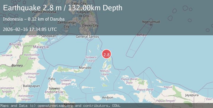
A 2.8 magnitude earthquake struck on North of Halmahera, Indonesia, at Mon, 16 Feb 2026 17:34:05 GMT. Depth: 132.2724km. Reviewed by BMKG seismologists, this minor quake occurred at a magnitude type of M.
Magnitude
2.8
M
Source
BMKG
Intensity
-
Agency Reports
1 Sources| Source | Magnitude | Depth | Time |
|---|---|---|---|
| BMKGPrimary | 2.8 | 132 km | 2 days ago |
Earthquake Details
ManualEvent IDbmg2026dhjx
Tsunami PotentialNo
Magnitude TypeM
Nearest Places
- Morotai Basin14.3 km
- Pulau Karis64.3 km
- Tanjung Berri Berri74.2 km
- Tanjung Padangi74.3 km
- Bere Bere75.5 km
Comments
Join the discussion about this event.
Latest Earthquakes
2.5Mag
Tarapaca, Chile
Time1 hour ago
Depth112.55 km
SourceVYT (Automatic)
2.2Mag
Tarapaca, Chile
Time1 hour ago
Depth111.94 km
SourceVYT (Automatic)
1.9Mag
Central Alaska
Time1 hour ago
Depth32.10 km
SourceVYT (Automatic)
3.4Mag
HAWAII REGION, HAWAII
Time1 hour ago
Depth4.70 km
SourceHV (Automatic)
1.9Mag
STRAIT OF GIBRALTAR
Time1 hour ago
Depth0.00 km
SourceIGN (Automatic)
Nearby Earthquakes
4.0Mag
NORTH OF HALMAHERA, INDONESIA
Time4 years ago
Depth88.00 km
SourceDJA (Automatic)
4.0Mag
NORTH OF HALMAHERA, INDONESIA
Time3 years ago
Depth93.00 km
SourceDJA (Automatic)
4.0Mag
NORTH OF HALMAHERA, INDONESIA
Time1 year ago
Depth119.00 km
SourceBMKG (Automatic)
5.0Mag
KEPULAUAN TALAUD, INDONESIA
Time4 years ago
Depth80.00 km
SourceEMSC (Automatic)
5.4Mag
NORTH OF HALMAHERA, INDONESIA
Time5 years ago
Depth100.00 km
SourceEMSC (Automatic)