Earthquake West Papua Region, Indonesia
Mon, 16 Feb 2026 17:53:59 GMT
Time2 days ago
Location
-1.5852, 134.4363
Depth
10.0 KM
Event Summary
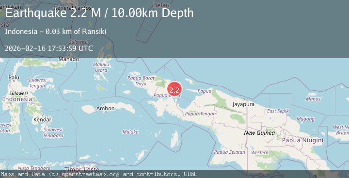
A 2.2 magnitude earthquake struck on West Papua Region, Indonesia, at Mon, 16 Feb 2026 17:53:59 GMT. Depth: 10km. Reviewed by BMKG seismologists, this minor quake occurred at a magnitude type of M.
Magnitude
2.2
M
Source
BMKG
Intensity
-
Agency Reports
1 Sources| Source | Magnitude | Depth | Time |
|---|---|---|---|
| BMKGPrimary | 2.2 | 10 km | 2 days ago |
Earthquake Details
ManualEvent IDbmg2026dhko
Tsunami PotentialNo
Magnitude TypeM
Nearest Places
- Pulau Wairundi24.7 km
- Tanjung Yori25.6 km
- Rapaolo27.3 km
- Kampung Bamaha27.4 km
- Uwi28.3 km
Comments
Join the discussion about this event.
Latest Earthquakes
3.0Mag
Minahasa, Sulawesi, Indonesia
Time33 minutes ago
Depth288.45 km
SourceVYT (Automatic)
1.8Mag
Central Alaska
Time37 minutes ago
Depth103.03 km
SourceVYT (Automatic)
2.6Mag
Northern Sumatra, Indonesia
Time37 minutes ago
Depth20.84 km
SourceBMKG
1.3Mag
Washington
Time39 minutes ago
Depth0.00 km
SourceVYT (Automatic)
1.6Mag
Kenai Peninsula, Alaska
Time39 minutes ago
Depth21.36 km
SourceVYT (Automatic)
Nearby Earthquakes
3.0Mag
NEAR N COAST OF PAPUA, INDONESIA
Time4 years ago
Depth10.00 km
SourceDJA (Automatic)
5.1Mag
NEAR N COAST OF PAPUA, INDONESIA
Time1 year ago
Depth36.00 km
SourceEMSC (Automatic)
3.0Mag
NEAR N COAST OF PAPUA, INDONESIA
Time5 months ago
Depth13.00 km
SourceBMKG (Automatic)
2.8Mag
NEAR N COAST OF PAPUA, INDONESIA
Time1 month ago
Depth11.00 km
SourceBMKG (Automatic)
3.0Mag
NEAR N COAST OF PAPUA, INDONESIA
Time1 year ago
Depth10.00 km
SourceBMKG (Automatic)