Earthquake Talaud Islands, Indonesia
Mon, 16 Feb 2026 18:14:18 GMT
Time2 days ago
Location
3.3189, 126.9305
Depth
92.7 KM
Event Summary
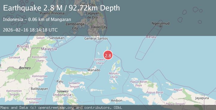
A 2.8 magnitude earthquake struck on Talaud Islands, Indonesia, at Mon, 16 Feb 2026 18:14:18 GMT. Depth: 92.720375km. Reviewed by BMKG seismologists, this minor quake occurred at a magnitude type of M.
Magnitude
2.8
M
Source
BMKG
Intensity
-
Agency Reports
1 Sources| Source | Magnitude | Depth | Time |
|---|---|---|---|
| BMKGPrimary | 2.8 | 93 km | 2 days ago |
Earthquake Details
ManualEvent IDbmg2026dhlg
Tsunami PotentialNo
Magnitude TypeM
Nearest Places
- Pulau Napumbalu36.4 km
- Tanjung Pallo47.1 km
- Tanjung Tatimbalangan48.0 km
- Taduwale48.3 km
- Damau48.4 km
Comments
Join the discussion about this event.
Latest Earthquakes
1.7Mag
Southeastern Alaska
Time23 hours ago
Depth18.43 km
SourceVYT (Automatic)
2.6Mag
Java, Indonesia
Time23 hours ago
Depth20.76 km
SourceBMKG
0.6Mag
NORTHERN ITALY
Time23 hours ago
Depth12.00 km
SourceOGS (Automatic)
2.7Mag
Alaska Peninsula
Time23 hours ago
Depth10.00 km
SourceVYT (Automatic)
1.8Mag
Southern Alaska
Time23 hours ago
Depth9.03 km
SourceVYT (Automatic)
Nearby Earthquakes
4.0Mag
KEPULAUAN TALAUD, INDONESIA
Time1 year ago
Depth39.00 km
SourceBMKG (Automatic)
4.6Mag
KEPULAUAN TALAUD, INDONESIA
Time1 month ago
Depth54.00 km
SourceEMSC (Automatic)
3.6Mag
Talaud Islands, Indonesia
Time0 months ago
Depth5.61 km
SourceBMKG (Automatic)
4.0Mag
KEPULAUAN TALAUD, INDONESIA
Time4 years ago
Depth10.00 km
SourceDJA (Automatic)
4.0Mag
KEPULAUAN TALAUD, INDONESIA
Time6 years ago
Depth10.00 km
SourceDJA (Automatic)