Earthquake Southeastern Alaska
Wed, 18 Feb 2026 11:31:05 GMT
Time2 hours ago
Location
60.2170, -141.0165
Depth
18.4 KM
Event Summary
A 1.7 magnitude earthquake struck on Southeastern Alaska, at Wed, 18 Feb 2026 11:31:05 GMT. Depth: 18.4326171875km. Reviewed by VYT seismologists, this minor quake occurred at a magnitude type of earthquake.
Magnitude
1.7
earthquake
Source
VYT
Intensity
-
Agency Reports
2 Sources| Source | Magnitude | Depth | Time |
|---|---|---|---|
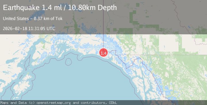
| VYTPrimary | 1.7 | 18 km | 2 hours ago |
| USGS | 1.4 | 11 km | 2 hours ago |
Earthquake Details
AutomaticEvent IDvyt_1izhr9747cu1l
Tsunami PotentialNo
Magnitude Typeearthquake
Nearest Places
- Haydon Peak5.0 km
- Libbey Glacier6.0 km
- Hoof Hill7.2 km
- Tyndall Glacier7.4 km
- Agassiz Lakes9.1 km
Comments
Join the discussion about this event.
Latest Earthquakes
1.4Mag
Central Alaska
Time18 minutes ago
Depth110.35 km
SourceVYT (Automatic)
1.3Mag
Southeastern Alaska
Time26 minutes ago
Depth0.00 km
SourceVYT (Automatic)
4.6Mag
Tarapaca, Chile
Time26 minutes ago
Depth115.11 km
SourceVYT (Automatic)
1.1Mag
Czech Republic
Time27 minutes ago
Depth0.00 km
SourceVYT (Automatic)
1.9Mag
Central Alaska
Time28 minutes ago
Depth141.85 km
SourceVYT (Automatic)
Nearby Earthquakes
1.8Mag
106 km NW of Yakutat, Alaska
Time4 days ago
Depth17.50 km
SourceUSGS (Automatic)
3.0Mag
SOUTHERN ALASKA
Time6 years ago
Depth4.00 km
SourceNEIC (Automatic)
1.6Mag
106 km NW of Yakutat, Alaska
Time4 days ago
Depth14.40 km
SourceUSGS (Automatic)
1.1Mag
Southeastern Alaska
Time2 days ago
Depth16.60 km
SourceVYT (Automatic)
2.0Mag
Southeastern Alaska
Time1 day ago
Depth19.90 km
SourceVYT (Automatic)