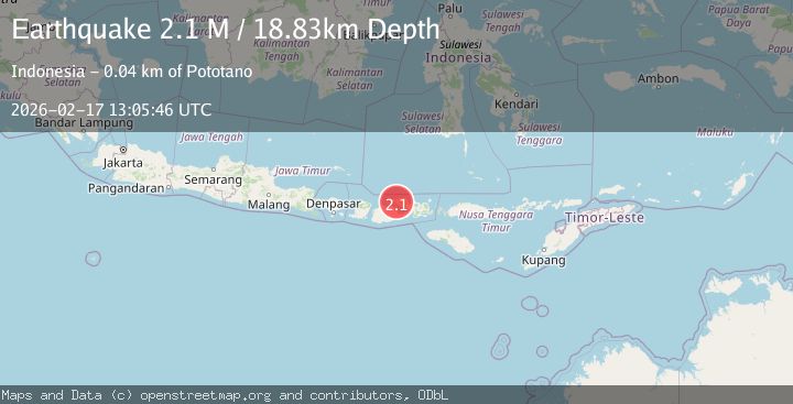
Earthquake Sumbawa Region, Indonesia
Tue, 17 Feb 2026 13:05:46 GMT
Time18 hours ago
Location
-8.2500, 117.7601
Depth
18.8 KM
Event Summary
A 2.1 magnitude earthquake struck on Sumbawa Region, Indonesia, at Tue, 17 Feb 2026 13:05:46 GMT. Depth: 18.826616km. Reviewed by BMKG seismologists, this minor quake occurred at a magnitude type of M.
Magnitude
2.1
M
Source
BMKG
Intensity
-
Agency Reports
1 Sources| Source | Magnitude | Depth | Time |
|---|---|---|---|
| BMKGPrimary | 2.1 | 19 km | 18 hours ago |
Earthquake Details
ManualEvent IDbmg2026diwo
Tsunami PotentialNo
Magnitude TypeM
Nearest Places
- Legamba0.8 km
- Sori Garuda1.2 km
- Doro Legamba1.4 km
- Desa Pekat2.6 km
- Doro Batu2.7 km
Comments
Join the discussion about this event.
Latest Earthquakes
2.9Mag
Northern Molucca Sea
Time19 hours ago
Depth10.45 km
SourceBMKG
2.9Mag
South of Java, Indonesia
Time19 hours ago
Depth10.00 km
SourceBMKG
3.2Mag
Potosi, Bolivia
Time19 hours ago
Depth238.53 km
SourceVYT (Automatic)
2.8Mag
WESTERN TURKEY
Time19 hours ago
Depth6.50 km
SourceKOERI (Automatic)
2.5Mag
Alaska Peninsula
Time19 hours ago
Depth0.00 km
SourceVYT (Automatic)
Nearby Earthquakes
2.1Mag
Sumbawa Region, Indonesia
Time3 weeks ago
Depth31.94 km
SourceBMKG (Automatic)
2.2Mag
Sumbawa Region, Indonesia
Time3 weeks ago
Depth10.00 km
SourceBMKG (Automatic)
2.4Mag
Sumbawa Region, Indonesia
Time3 weeks ago
Depth20.76 km
SourceBMKG (Automatic)
2.3Mag
Sumbawa Region, Indonesia
Time3 weeks ago
Depth10.00 km
SourceBMKG (Automatic)
3.1Mag
SUMBAWA REGION, INDONESIA
Time1 month ago
Depth21.00 km
SourceBMKG (Automatic)