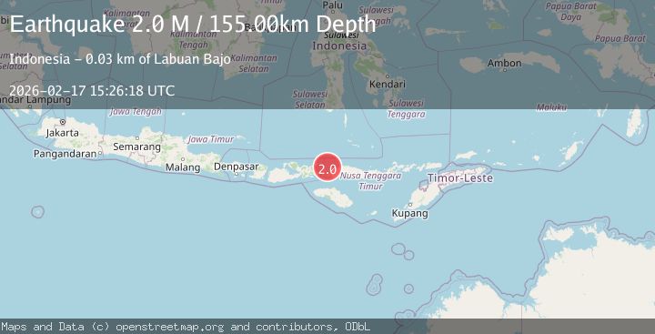
Earthquake Flores Region, Indonesia
Tue, 17 Feb 2026 15:26:18 GMT
Time20 hours ago
Location
-8.3223, 119.6466
Depth
155.0 KM
Event Summary
A 2.0 magnitude earthquake struck on Flores Region, Indonesia, at Tue, 17 Feb 2026 15:26:18 GMT. Depth: 154.997131km. Reviewed by BMKG seismologists, this minor quake occurred at a magnitude type of M.
Magnitude
2.0
M
Source
BMKG
Intensity
-
Agency Reports
1 Sources| Source | Magnitude | Depth | Time |
|---|---|---|---|
| BMKGPrimary | 2.0 | 155 km | 20 hours ago |
Earthquake Details
ManualEvent IDbmg2026djbf
Tsunami PotentialNo
Magnitude TypeM
Nearest Places
- Gili Lawalaut16.4 km
- Sabolan-kecil18.6 km
- Gili Lawadarat19.1 km
- Sabolan-besar19.8 km
- Loho Gebah20.8 km
Comments
Join the discussion about this event.
Latest Earthquakes
2.7Mag
northwestern Russia
Time20 hours ago
Depth10.00 km
SourceVYT (Automatic)
3.6Mag
DODECANESE ISLANDS, GREECE
Time20 hours ago
Depth6.00 km
SourceTHE (Automatic)
1.1Mag
Kenai Peninsula, Alaska
Time20 hours ago
Depth53.22 km
SourceVYT (Automatic)
3.1Mag
Savu Sea
Time20 hours ago
Depth86.30 km
SourceVYT (Automatic)
2.6Mag
Java, Indonesia
Time21 hours ago
Depth144.90 km
SourceVYT (Automatic)
Nearby Earthquakes
4.0Mag
FLORES REGION, INDONESIA
Time6 years ago
Depth173.00 km
SourceDJA (Automatic)
3.0Mag
FLORES REGION, INDONESIA
Time1 year ago
Depth162.00 km
SourceBMKG (Automatic)
3.1Mag
Flores region, Indonesia
Time1 week ago
Depth10.00 km
SourceVYT (Automatic)
3.0Mag
FLORES REGION, INDONESIA
Time2 years ago
Depth137.00 km
SourceBMKG (Automatic)
3.0Mag
FLORES REGION, INDONESIA
Time10 months ago
Depth158.00 km
SourceBMKG (Automatic)