Earthquake Northern Sumatra, Indonesia
Tue, 17 Feb 2026 19:04:18 GMT
Time10 hours ago
Location
4.6085, 96.2444
Depth
7.7 KM
Event Summary
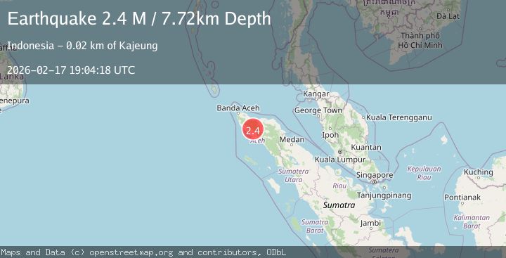
A 2.4 magnitude earthquake struck on Northern Sumatra, Indonesia, at Tue, 17 Feb 2026 19:04:18 GMT. Depth: 7.719224km. Reviewed by BMKG seismologists, this minor quake occurred at a magnitude type of M.
Magnitude
2.4
M
Source
BMKG
Intensity
-
Agency Reports
1 Sources| Source | Magnitude | Depth | Time |
|---|---|---|---|
| BMKGPrimary | 2.4 | 8 km | 10 hours ago |
Earthquake Details
ManualEvent IDbmg2026djik
Tsunami PotentialNo
Magnitude TypeM
Nearest Places
- Krueng Sudawa3.6 km
- Krueng Sitampaue5.4 km
- Anu7.2 km
- Gunung Pucok Aluegasih7.3 km
- Krueng Pameue7.3 km
Comments
Join the discussion about this event.
Latest Earthquakes
2.3Mag
Tarapaca, Chile
Time10 hours ago
Depth61.65 km
SourceVYT (Automatic)
2.0Mag
Poland
Time10 hours ago
Depth2.32 km
SourceVYT (Automatic)
1.1Mag
4 km SSE of Banning, CA
Time10 hours ago
Depth15.73 km
SourceUSGS (Automatic)
2.0Mag
Kenai Peninsula, Alaska
Time10 hours ago
Depth187.74 km
SourceVYT (Automatic)
2.7Mag
off the coast of Tarapaca, Chile
Time10 hours ago
Depth0.00 km
SourceVYT (Automatic)
Nearby Earthquakes
3.0Mag
NORTHERN SUMATRA, INDONESIA
Time6 months ago
Depth5.00 km
SourceBMKG (Automatic)
3.0Mag
NORTHERN SUMATRA, INDONESIA
Time3 years ago
Depth11.00 km
SourceDJA (Automatic)
6.3Mag
NORTHERN SUMATRA, INDONESIA
Time20 years ago
Depth33.00 km
SourceEMSC (Automatic)
3.0Mag
NORTHERN SUMATRA, INDONESIA
Time3 years ago
Depth10.00 km
SourceDJA (Automatic)
3.0Mag
NORTHERN SUMATRA, INDONESIA
Time3 months ago
Depth10.00 km
SourceBMKG (Automatic)