Earthquake Sumbawa Region, Indonesia
Wed, 18 Feb 2026 01:33:08 GMT
Time9 hours ago
Location
-8.2225, 117.6877
Depth
21.9 KM
Event Summary
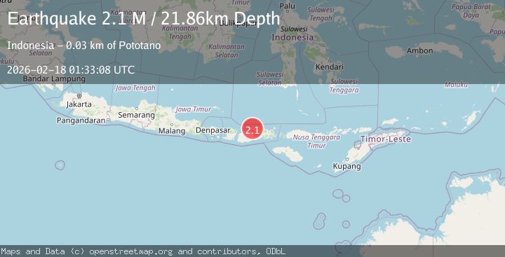
A 2.1 magnitude earthquake struck on Sumbawa Region, Indonesia, at Wed, 18 Feb 2026 01:33:08 GMT. Depth: 21.858425km. Reviewed by BMKG seismologists, this minor quake occurred at a magnitude type of M.
Magnitude
2.1
M
Source
BMKG
Intensity
-
Agency Reports
1 Sources| Source | Magnitude | Depth | Time |
|---|---|---|---|
| BMKGPrimary | 2.1 | 22 km | 9 hours ago |
Earthquake Details
ManualEvent IDbmg2026djvf
Tsunami PotentialNo
Magnitude TypeM
Nearest Places
- Tandjung Pekat1.3 km
- Tanjung Pasir1.4 km
- Teluk Calabai2.2 km
- Tanjung Calabai2.5 km
- Asramapiner2.7 km
Comments
Join the discussion about this event.
Latest Earthquakes
4.0Mag
northwest of Australia
Time9 hours ago
Depth91.80 km
SourceVYT (Automatic)
1.8Mag
Tarapaca, Chile
Time9 hours ago
Depth16.60 km
SourceVYT (Automatic)
2.1Mag
Java, Indonesia
Time9 hours ago
Depth13.22 km
SourceBMKG
2.4Mag
Sumbawa Region, Indonesia
Time9 hours ago
Depth29.92 km
SourceBMKG
1.2Mag
Central Alaska
Time9 hours ago
Depth72.27 km
SourceVYT (Automatic)
Nearby Earthquakes
3.0Mag
SUMBAWA REGION, INDONESIA
Time4 years ago
Depth10.00 km
SourceDJA (Automatic)
2.0Mag
Sumbawa Region, Indonesia
Time3 days ago
Depth18.34 km
SourceBMKG
2.1Mag
Sumbawa Region, Indonesia
Time3 days ago
Depth7.82 km
SourceBMKG
2.2Mag
Sumbawa Region, Indonesia
Time3 days ago
Depth10.00 km
SourceBMKG
2.1Mag
Sumbawa Region, Indonesia
Time3 days ago
Depth20.76 km
SourceBMKG