Earthquake Southern Sumatra, Indonesia
Wed, 18 Feb 2026 08:20:25 GMT
Time7 hours ago
Location
-5.1647, 102.5592
Depth
10.0 KM
Event Summary
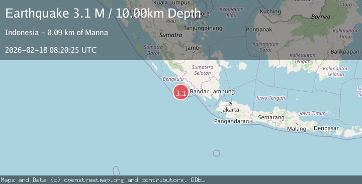
A 3.1 magnitude earthquake struck on Southern Sumatra, Indonesia, at Wed, 18 Feb 2026 08:20:25 GMT. Depth: 10km. Reviewed by BMKG seismologists, this minor quake occurred at a magnitude type of M.
Magnitude
3.1
M
Source
BMKG
Intensity
-
Agency Reports
1 Sources| Source | Magnitude | Depth | Time |
|---|---|---|---|
| BMKGPrimary | 3.1 | 10 km | 7 hours ago |
Earthquake Details
ManualEvent IDbmg2026dkir
Tsunami PotentialNo
Magnitude TypeM
Nearest Places
- Tanjung Kaana30.8 km
- Kijah32.2 km
- Taoabi32.8 km
- Tanjung Kanuhujo33.0 km
- Teluk Enggano33.2 km
Comments
Join the discussion about this event.
Latest Earthquakes
0.9Mag
63 km E of Pedro Bay, Alaska
Time7 hours ago
Depth116.20 km
SourceUSGS (Automatic)
1.7Mag
Southern Alaska
Time7 hours ago
Depth0.00 km
SourceVYT (Automatic)
0.9Mag
92 km SSE of Kokhanok, Alaska
Time7 hours ago
Depth13.30 km
SourceUSGS (Automatic)
2.6Mag
near the coast of Tarapaca, Chile
Time7 hours ago
Depth0.49 km
SourceVYT (Automatic)
2.9Mag
northern Colombia
Time7 hours ago
Depth10.00 km
SourceVYT (Automatic)
Nearby Earthquakes
3.0Mag
SOUTHERN SUMATRA, INDONESIA
Time5 years ago
Depth10.00 km
SourceDJA (Automatic)
6.0Mag
SOUTHERN SUMATRA, INDONESIA
Time15 years ago
Depth28.00 km
SourceEMSC (Automatic)
4.0Mag
SOUTHERN SUMATRA, INDONESIA
Time7 years ago
Depth21.00 km
SourceDJA (Automatic)
3.0Mag
SOUTHERN SUMATRA, INDONESIA
Time5 years ago
Depth10.00 km
SourceDJA (Automatic)
3.0Mag
SOUTHERN SUMATRA, INDONESIA
Time10 months ago
Depth10.00 km
SourceBMKG (Automatic)