Earthquake SOUTHERN SUMATRA, INDONESIA
Mon, 17 Jan 2011 19:20:56 GMT
Time15 years ago
Location
-5.1200, 102.5500
Depth
28.0 KM
Event Summary
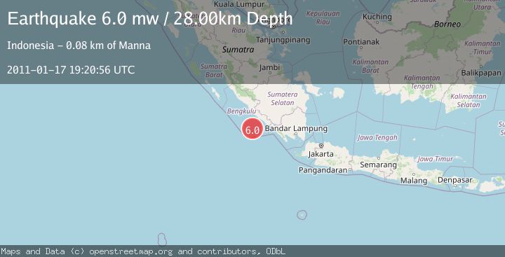
A 6.0 magnitude earthquake struck on SOUTHERN SUMATRA, INDONESIA, at Mon, 17 Jan 2011 19:20:56 GMT. Depth: 28km. Reviewed by EMSC seismologists, this strong quake occurred at a magnitude type of mw.
Magnitude
6.0
mw
Source
EMSC
Intensity
-
Agency Reports
1 Sources| Source | Magnitude | Depth | Time |
|---|---|---|---|
| EMSCPrimary | 6.0 | 28 km | 15 years ago |
Earthquake Details
AutomaticEvent IDemsc_EMSC_20110117_0000048
Tsunami PotentialNo
Magnitude Typemw
Nearest Places
- Tanjung Kaana34.4 km
- Kijah35.3 km
- Taoabi36.3 km
- Batang Kuwau36.7 km
- Tanjung Kanuhujo36.8 km
Comments
Join the discussion about this event.
Latest Earthquakes
2.5Mag
Java, Indonesia
Time5 minutes ago
Depth76.49 km
SourceBMKG
1.9Mag
Tarapaca, Chile
Time10 minutes ago
Depth7.93 km
SourceVYT (Automatic)
2.4Mag
West Papua Region, Indonesia
Time11 minutes ago
Depth10.00 km
SourceBMKG
2.7Mag
Antofagasta, Chile
Time13 minutes ago
Depth0.00 km
SourceVYT (Automatic)
2.7Mag
Tarapaca, Chile
Time18 minutes ago
Depth10.50 km
SourceVYT (Automatic)
Nearby Earthquakes
3.0Mag
SOUTHERN SUMATRA, INDONESIA
Time5 years ago
Depth10.00 km
SourceDJA (Automatic)
3.1Mag
Southern Sumatra, Indonesia
Time8 hours ago
Depth10.00 km
SourceBMKG
3.0Mag
SOUTHERN SUMATRA, INDONESIA
Time5 years ago
Depth10.00 km
SourceDJA (Automatic)
3.0Mag
SOUTHERN SUMATRA, INDONESIA
Time5 years ago
Depth37.00 km
SourceDJA (Automatic)
4.0Mag
SOUTHERN SUMATRA, INDONESIA
Time7 years ago
Depth21.00 km
SourceDJA (Automatic)