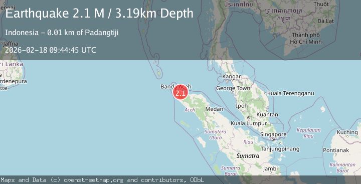
Earthquake Northern Sumatra, Indonesia
Wed, 18 Feb 2026 09:44:45 GMT
Time6 hours ago
Location
5.3993, 95.7376
Depth
3.2 KM
Event Summary
A 2.1 magnitude earthquake struck on Northern Sumatra, Indonesia, at Wed, 18 Feb 2026 09:44:45 GMT. Depth: 3.187278km. Reviewed by BMKG seismologists, this minor quake occurred at a magnitude type of M.
Magnitude
2.1
M
Source
BMKG
Intensity
-
Agency Reports
1 Sources| Source | Magnitude | Depth | Time |
|---|---|---|---|
| BMKGPrimary | 2.1 | 3 km | 6 hours ago |
Earthquake Details
ManualEvent IDbmg2026dkll
Tsunami PotentialNo
Magnitude TypeM
Nearest Places
- Krueng Blangong Basah1.5 km
- Gle Ujeuen Lingkee1.8 km
- Cot Awemeulu2.0 km
- Alue Lhobateeleuca2.5 km
- Cot Babahlubue2.6 km
Comments
Join the discussion about this event.
Latest Earthquakes
2.2Mag
Estonia
Time5 hours ago
Depth14.04 km
SourceVYT (Automatic)
2.2Mag
FRANCE
Time5 hours ago
Depth5.00 km
SourceReNaSS (Automatic)
2.5Mag
northern Alaska
Time5 hours ago
Depth135.99 km
SourceVYT (Automatic)
1.4Mag
Czech Republic
Time6 hours ago
Depth31.62 km
SourceVYT (Automatic)
2.1Mag
Southeastern Alaska
Time6 hours ago
Depth0.00 km
SourceVYT (Automatic)
Nearby Earthquakes
3.0Mag
NORTHERN SUMATRA, INDONESIA
Time5 years ago
Depth10.00 km
SourceDJA (Automatic)
2.4Mag
Northern Sumatra, Indonesia
Time3 weeks ago
Depth7.88 km
SourceBMKG (Automatic)
3.0Mag
NORTHERN SUMATRA, INDONESIA
Time1 year ago
Depth10.00 km
SourceBMKG (Automatic)
3.0Mag
NORTHERN SUMATRA, INDONESIA
Time4 years ago
Depth10.00 km
SourceDJA (Automatic)
3.0Mag
NORTHERN SUMATRA, INDONESIA
Time5 years ago
Depth91.00 km
SourceDJA (Automatic)