Earthquake West Papua Region, Indonesia
Wed, 18 Feb 2026 18:44:40 GMT
Time1 hour ago
Location
-0.5709, 135.1492
Depth
10.0 KM
Event Summary
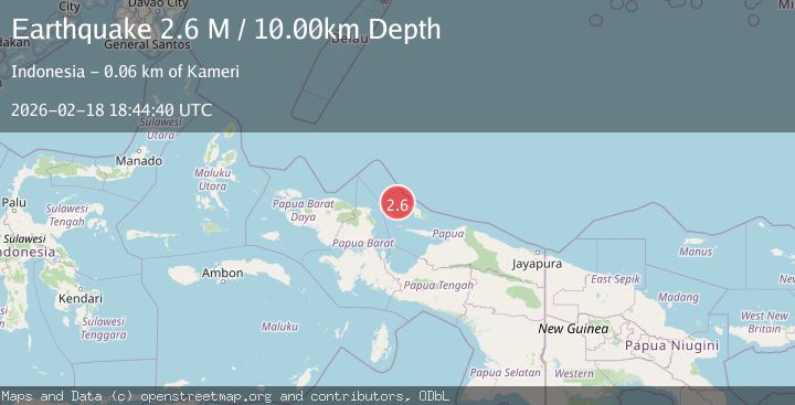
A 2.6 magnitude earthquake struck on West Papua Region, Indonesia, at Wed, 18 Feb 2026 18:44:40 GMT. Depth: 10km. Reviewed by BMKG seismologists, this minor quake occurred at a magnitude type of M.
Magnitude
2.6
M
Source
BMKG
Intensity
-
Agency Reports
1 Sources| Source | Magnitude | Depth | Time |
|---|---|---|---|
| BMKGPrimary | 2.6 | 10 km | 1 hour ago |
Earthquake Details
ManualEvent IDbmg2026dldg
Tsunami PotentialNo
Magnitude TypeM
Nearest Places
- Karang Isabela13.3 km
- Pulau Bepondi22.5 km
- Bespondi23.2 km
- Gosong Bepondi24.4 km
- Tanjung Mandundi25.4 km
Comments
Join the discussion about this event.
Latest Earthquakes
1.2Mag
Central Alaska
Time1 hour ago
Depth0.85 km
SourceVYT (Automatic)
2.6Mag
Antofagasta, Chile
Time1 hour ago
Depth0.00 km
SourceVYT (Automatic)
2.8Mag
Fox Islands, Aleutian Islands, Alaska
Time1 hour ago
Depth80.44 km
SourceVYT (Automatic)
0.9Mag
110 km S of McCarthy, Alaska
Time1 hour ago
Depth18.50 km
SourceUSGS (Automatic)
3.0Mag
Central Alaska
Time1 hour ago
Depth0.12 km
SourceVYT (Automatic)
Nearby Earthquakes
4.0Mag
BIAK REGION, INDONESIA
Time5 years ago
Depth10.00 km
SourceNEIC (Automatic)
3.1Mag
BIAK REGION, INDONESIA
Time0 months ago
Depth10.00 km
SourceBMKG (Automatic)
5.1Mag
NEAR N COAST OF PAPUA, INDONESIA
Time16 years ago
Depth40.00 km
SourceEMSC (Automatic)
3.0Mag
West Papua Region, Indonesia
Time3 weeks ago
Depth10.00 km
SourceBMKG (Automatic)
3.0Mag
BIAK REGION, INDONESIA
Time10 months ago
Depth15.00 km
SourceBMKG (Automatic)