Earthquake Near North Coast of West Papua
Wed, 18 Feb 2026 19:13:40 GMT
Time2 hours ago
Location
-2.6628, 139.4814
Depth
46.3 KM
Event Summary
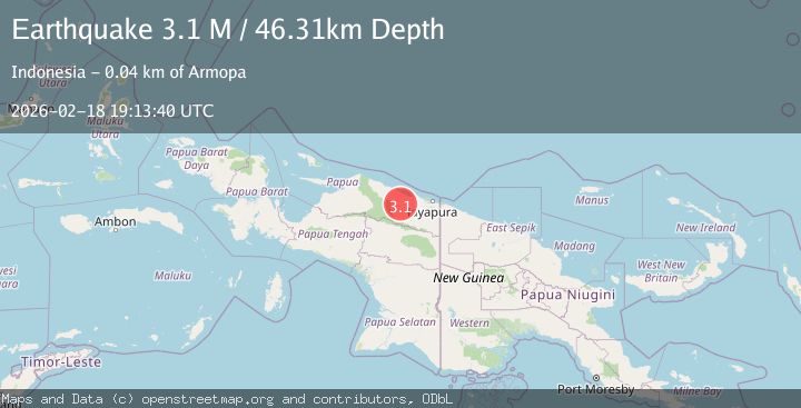
A 3.1 magnitude earthquake struck on Near North Coast of West Papua, at Wed, 18 Feb 2026 19:13:40 GMT. Depth: 46.306995km. Reviewed by BMKG seismologists, this minor quake occurred at a magnitude type of M.
Magnitude
3.1
M
Source
BMKG
Intensity
-
Agency Reports
1 Sources| Source | Magnitude | Depth | Time |
|---|---|---|---|
| BMKGPrimary | 3.1 | 46 km | 2 hours ago |
Earthquake Details
ManualEvent IDbmg2026dleg
Tsunami PotentialNo
Magnitude TypeM
Nearest Places
- Air Wages7.3 km
- Sungai Wirubeteknala8.7 km
- Siggih9.6 km
- Arsoo10.0 km
- Provinsi Papua10.9 km
Comments
Join the discussion about this event.
Latest Earthquakes
1.3Mag
Washington
Time2 hours ago
Depth0.00 km
SourceVYT (Automatic)
1.6Mag
Kenai Peninsula, Alaska
Time2 hours ago
Depth21.36 km
SourceVYT (Automatic)
2.3Mag
Halmahera, Indonesia
Time2 hours ago
Depth7.28 km
SourceBMKG
2.9Mag
Halmahera, Indonesia
Time2 hours ago
Depth20.39 km
SourceVYT (Automatic)
1.9Mag
Central Alaska
Time2 hours ago
Depth87.40 km
SourceVYT (Automatic)
Nearby Earthquakes
2.7Mag
NEAR N COAST OF PAPUA, INDONESIA
Time1 month ago
Depth34.00 km
SourceBMKG (Automatic)
3.0Mag
NEAR N COAST OF PAPUA, INDONESIA
Time5 months ago
Depth26.00 km
SourceBMKG (Automatic)
3.0Mag
NEAR N COAST OF PAPUA, INDONESIA
Time3 years ago
Depth10.00 km
SourceDJA (Automatic)
5.1Mag
NEAR N COAST OF PAPUA, INDONESIA
Time8 years ago
Depth108.00 km
SourceEMSC (Automatic)
2.6Mag
NEAR N COAST OF PAPUA, INDONESIA
Time1 month ago
Depth49.00 km
SourceBMKG (Automatic)