Earthquake NEAR N COAST OF PAPUA, INDONESIA
Wed, 07 Jan 2026 00:58:45 GMT
Time1 month ago
Location
-2.7000, 139.5000
Depth
34.0 KM
Event Summary
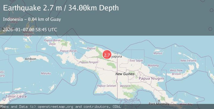
A 2.7 magnitude earthquake struck on NEAR N COAST OF PAPUA, INDONESIA, at Wed, 07 Jan 2026 00:58:45 GMT. Depth: 34km. Reviewed by BMKG seismologists, this minor quake occurred at a magnitude type of m.
Magnitude
2.7
m
Source
BMKG
Intensity
-
Agency Reports
1 Sources| Source | Magnitude | Depth | Time |
|---|---|---|---|
| BMKGPrimary | 2.7 | 34 km | 1 month ago |
Earthquake Details
AutomaticEvent IDemsc_BMKG_20260107_0000015
Tsunami PotentialNo
Magnitude Typem
Nearest Places
- Sungai Wirubeteknala4.7 km
- Siggih9.3 km
- Arsoo10.5 km
- Air Wages11.1 km
- Buero12.9 km
Comments
Join the discussion about this event.
Latest Earthquakes
2.8Mag
Sunda Strait, Indonesia
Time6 minutes ago
Depth3.61 km
SourceBMKG
3.6Mag
south of Alaska
Time7 minutes ago
Depth10.00 km
SourceVYT (Automatic)
1.2Mag
Central Alaska
Time9 minutes ago
Depth68.97 km
SourceVYT (Automatic)
1.2Mag
Washington
Time11 minutes ago
Depth0.00 km
SourceVYT (Automatic)
0.8Mag
10 km WNW of The Geysers, CA
Time17 minutes ago
Depth1.96 km
SourceUSGS (Automatic)
Nearby Earthquakes
5.1Mag
NEAR N COAST OF PAPUA, INDONESIA
Time8 years ago
Depth108.00 km
SourceEMSC (Automatic)
2.6Mag
NEAR N COAST OF PAPUA, INDONESIA
Time1 month ago
Depth49.00 km
SourceBMKG (Automatic)
3.0Mag
NEAR N COAST OF PAPUA, INDONESIA
Time5 months ago
Depth26.00 km
SourceBMKG (Automatic)
5.1Mag
NEAR N COAST OF PAPUA, INDONESIA
Time1 year ago
Depth30.00 km
SourceEMSC (Automatic)
3.0Mag
NEAR N COAST OF PAPUA, INDONESIA
Time6 years ago
Depth39.00 km
SourceDJA (Automatic)