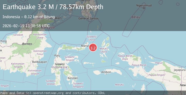
Earthquake Northern Molucca Sea
Thu, 19 Feb 2026 13:30:56 GMT
Time1 hour ago
Location
0.7580, 126.0447
Depth
12.1 KM
Event Summary
A 3.1 magnitude earthquake struck on Northern Molucca Sea, at Thu, 19 Feb 2026 13:30:56 GMT. Depth: 12.053123km. Reviewed by BMKG seismologists, this minor quake occurred at a magnitude type of M.
Magnitude
3.1
M
Source
BMKG
Intensity
-
Agency Reports
1 Sources| Source | Magnitude | Depth | Time |
|---|---|---|---|
| BMKGPrimary | 3.1 | 12 km | 1 hour ago |
Earthquake Details
ManualEvent IDbmg2026dmok
Tsunami PotentialNo
Magnitude TypeM
Nearest Places
- Kelurahan Tifure25.9 km
- Pulau Tifore26.2 km
- Kelurahan Pantai Sagu26.4 km
- Pulau Gureda27.9 km
- Maluku Sea29.1 km
Comments
Join the discussion about this event.
Latest Earthquakes
1.3Mag
Oregon
Time1 hour ago
Depth0.00 km
SourceVYT (Automatic)
2.0Mag
Tarapaca, Chile
Time1 hour ago
Depth104.13 km
SourceVYT (Automatic)
2.0Mag
Tarapaca, Chile
Time1 hour ago
Depth120.97 km
SourceVYT (Automatic)
0.2Mag
8 km W of Cobb, CA
Time1 hour ago
Depth1.64 km
SourceUSGS (Automatic)
4.6Mag
Mindanao, Philippines
Time1 hour ago
Depth62.27 km
SourceBMKG
Nearby Earthquakes
3.0Mag
MOLUCCA SEA
Time9 months ago
Depth15.00 km
SourceBMKG (Automatic)
3.0Mag
MOLUCCA SEA
Time3 years ago
Depth11.00 km
SourceDJA (Automatic)
4.0Mag
MOLUCCA SEA
Time1 year ago
Depth65.90 km
SourceEMSC (Automatic)
3.0Mag
MOLUCCA SEA
Time3 weeks ago
Depth10.00 km
SourceBMKG (Automatic)
5.0Mag
MOLUCCA SEA
Time1 year ago
Depth46.00 km
SourceEMSC (Automatic)