Earthquake Southwest of Sumatra, Indonesia
Thu, 19 Feb 2026 15:11:14 GMT
Time1 hour ago
Location
-6.1954, 103.7700
Depth
10.0 KM
Event Summary
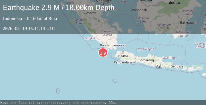
A 2.9 magnitude earthquake struck on Southwest of Sumatra, Indonesia, at Thu, 19 Feb 2026 15:11:14 GMT. Depth: 10km. Reviewed by BMKG seismologists, this minor quake occurred at a magnitude type of M.
Magnitude
2.9
M
Source
BMKG
Intensity
-
Agency Reports
1 Sources| Source | Magnitude | Depth | Time |
|---|---|---|---|
| BMKGPrimary | 2.9 | 10 km | 1 hour ago |
Earthquake Details
ManualEvent IDbmg2026dmrs
Tsunami PotentialNo
Magnitude TypeM
Nearest Places
- Enggano Basin21.9 km
- Pulau Betuah81.7 km
- Tanjung Cuku Balimbing84.6 km
- Cukuh Batuberagam86.2 km
- Wai Cukung86.9 km
Comments
Join the discussion about this event.
Latest Earthquakes
2.4Mag
Poland
Time1 hour ago
Depth2.81 km
SourceVYT (Automatic)
2.6Mag
Java, Indonesia
Time1 hour ago
Depth16.69 km
SourceBMKG
0.8Mag
7 km NW of The Geysers, CA
Time1 hour ago
Depth2.76 km
SourceUSGS (Automatic)
1.9Mag
Kenai Peninsula, Alaska
Time1 hour ago
Depth19.17 km
SourceVYT (Automatic)
1.3Mag
8 km NW of The Geysers, CA
Time1 hour ago
Depth1.51 km
SourceUSGS (Automatic)
Nearby Earthquakes
5.1Mag
SOUTHWEST OF SUMATRA, INDONESIA
Time3 years ago
Depth40.00 km
SourceEMSC (Automatic)
4.0Mag
SOUTHWEST OF SUMATRA, INDONESIA
Time4 years ago
Depth10.00 km
SourceDJA (Automatic)
3.0Mag
SOUTHWEST OF SUMATRA, INDONESIA
Time3 years ago
Depth10.00 km
SourceDJA (Automatic)
5.2Mag
SOUTHWEST OF SUMATRA, INDONESIA
Time5 years ago
Depth38.00 km
SourceEMSC (Automatic)
5.2Mag
SOUTHWEST OF SUMATRA, INDONESIA
Time1 year ago
Depth10.00 km
SourceEMSC (Automatic)