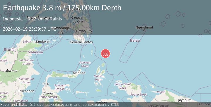
Earthquake Talaud Islands, Indonesia
Thu, 19 Feb 2026 23:40:12 GMT
Time1 hour ago
Location
3.0801, 127.9460
Depth
10.0 KM
Event Summary
A 3.2 magnitude earthquake struck on Talaud Islands, Indonesia, at Thu, 19 Feb 2026 23:40:12 GMT. Depth: 10km. Reviewed by BMKG seismologists, this minor quake occurred at a magnitude type of M.
Magnitude
3.2
M
Source
BMKG
Intensity
-
Agency Reports
1 Sources| Source | Magnitude | Depth | Time |
|---|---|---|---|
| BMKGPrimary | 3.2 | 10 km | 1 hour ago |
Earthquake Details
ManualEvent IDbmg2026dnin
Tsunami PotentialNo
Magnitude TypeM
Nearest Places
- Morotai Basin10.7 km
- Pulau Karis55.2 km
- Pulau Tuanane78.0 km
- Tanjung Papaye78.2 km
- Tanjung Berri Berri78.2 km
Comments
Join the discussion about this event.
Latest Earthquakes
1.9Mag
Poland
Time2 hours ago
Depth10.01 km
SourceVYT (Automatic)
1.6Mag
10 km W of Pine Valley, CA
Time2 hours ago
Depth16.88 km
SourceUSGS (Automatic)
2.4Mag
West Papua Region, Indonesia
Time2 hours ago
Depth10.00 km
SourceBMKG
4.5Mag
Tarapaca, Chile
Time2 hours ago
Depth128.42 km
SourceVYT (Automatic)
2.3Mag
PUERTO RICO
Time2 hours ago
Depth15.50 km
SourcePR (Automatic)
Nearby Earthquakes
5.4Mag
KEPULAUAN TALAUD, INDONESIA
Time7 years ago
Depth94.00 km
SourceEMSC (Automatic)
4.0Mag
KEPULAUAN TALAUD, INDONESIA
Time4 years ago
Depth40.00 km
SourceDJA (Automatic)
5.0Mag
KEPULAUAN TALAUD, INDONESIA
Time4 years ago
Depth80.00 km
SourceEMSC (Automatic)
4.0Mag
NORTH OF HALMAHERA, INDONESIA
Time4 years ago
Depth88.00 km
SourceDJA (Automatic)
4.0Mag
KEPULAUAN TALAUD, INDONESIA
Time2 years ago
Depth10.00 km
SourceDJA (Automatic)