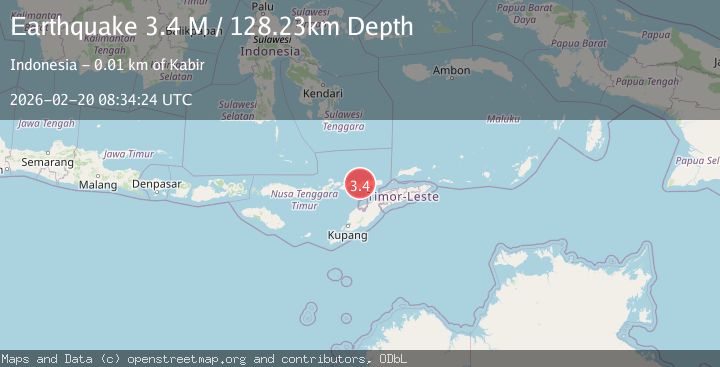
Earthquake Timor Region
Fri, 20 Feb 2026 08:34:24 GMT
Time1 hour ago
Location
-8.3471, 124.1059
Depth
134.7 KM
Event Summary
A 2.6 magnitude earthquake struck on Timor Region, at Fri, 20 Feb 2026 08:34:24 GMT. Depth: 134.661758km. Reviewed by BMKG seismologists, this minor quake occurred at a magnitude type of M.
Magnitude
2.6
M
Source
BMKG
Intensity
-
Agency Reports
1 Sources| Source | Magnitude | Depth | Time |
|---|---|---|---|
| BMKGPrimary | 2.6 | 135 km | 1 hour ago |
Earthquake Details
ManualEvent IDbmg2026doad
Tsunami PotentialNo
Magnitude TypeM
Nearest Places
- Teluk Blangmerang0.3 km
- Tanjung Kataru1.4 km
- Desa Baranusa1.7 km
- Pelabuhan Baranusa1.9 km
- Salu Sigaldoling2.2 km
Comments
Join the discussion about this event.
Latest Earthquakes
4.8Mag
offshore Coquimbo, Chile
Time1 hour ago
Depth0.24 km
SourceVYT (Automatic)
3.5Mag
OFF E. COAST OF N. ISLAND, N.Z.
Time1 hour ago
Depth10.00 km
SourceGNS (Automatic)
2.7Mag
Tarapaca, Chile
Time1 hour ago
Depth93.63 km
SourceVYT (Automatic)
2.8Mag
STRAIT OF GIBRALTAR
Time1 hour ago
Depth63.10 km
SourceIGN (Automatic)
3.5Mag
Seram, Indonesia
Time1 hour ago
Depth10.00 km
SourceBMKG
Nearby Earthquakes
2.6Mag
KEPULAUAN ALOR, INDONESIA
Time1 month ago
Depth179.00 km
SourceBMKG (Automatic)
3.0Mag
KEPULAUAN ALOR, INDONESIA
Time3 months ago
Depth132.00 km
SourceBMKG (Automatic)
3.0Mag
KEPULAUAN ALOR, INDONESIA
Time4 years ago
Depth40.00 km
SourceDJA (Automatic)
4.0Mag
FLORES REGION, INDONESIA
Time7 months ago
Depth150.00 km
SourceBMKG (Automatic)
2.6Mag
Timor Region
Time6 days ago
Depth17.46 km
SourceBMKG