Earthquake Talaud Islands, Indonesia
Fri, 20 Feb 2026 09:16:40 GMT
Time1 hour ago
Location
4.8086, 125.7823
Depth
15.7 KM
Event Summary
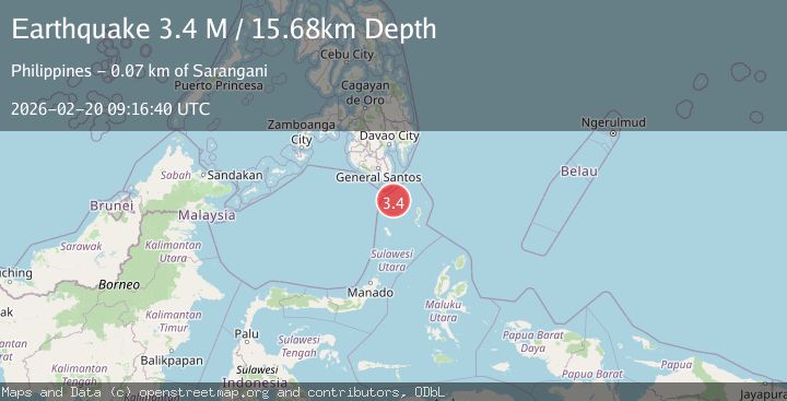
A 3.4 magnitude earthquake struck on Talaud Islands, Indonesia, at Fri, 20 Feb 2026 09:16:40 GMT. Depth: 15.67608km. Reviewed by BMKG seismologists, this minor quake occurred at a magnitude type of M.
Magnitude
3.4
M
Source
BMKG
Intensity
-
Agency Reports
1 Sources| Source | Magnitude | Depth | Time |
|---|---|---|---|
| BMKGPrimary | 3.4 | 16 km | 1 hour ago |
Earthquake Details
ManualEvent IDbmg2026dobn
Tsunami PotentialNo
Magnitude TypeM
Nearest Places
- Pulau Ehise27.1 km
- Pulau Memanu29.6 km
- Pulau Lungguhe32.9 km
- Pulau Laweang33.0 km
- Pulau Batubawaikang33.1 km
Comments
Join the discussion about this event.
Latest Earthquakes
1.2Mag
Southeastern Alaska
Time1 hour ago
Depth0.00 km
SourceVYT (Automatic)
2.9Mag
OFFSHORE EL SALVADOR
Time1 hour ago
Depth22.00 km
SourceINET (Automatic)
1.2Mag
EASTERN TURKEY
Time1 hour ago
Depth7.00 km
SourceAFAD (Automatic)
1.7Mag
western Texas
Time1 hour ago
Depth0.00 km
SourceVYT (Automatic)
2.2Mag
AEGEAN SEA
Time1 hour ago
Depth16.50 km
SourceKOERI (Automatic)
Nearby Earthquakes
4.0Mag
KEPULAUAN SANGIHE, INDONESIA
Time7 years ago
Depth185.00 km
SourcePIVS (Automatic)
5.0Mag
KEPULAUAN SANGIHE, INDONESIA
Time13 years ago
Depth179.00 km
SourceEMSC (Automatic)
3.0Mag
KEPULAUAN SANGIHE, INDONESIA
Time1 year ago
Depth58.00 km
SourcePIVS (Automatic)
4.0Mag
KEPULAUAN SANGIHE, INDONESIA
Time5 months ago
Depth175.00 km
SourceBMKG (Automatic)
3.0Mag
KEPULAUAN SANGIHE, INDONESIA
Time1 year ago
Depth122.00 km
SourcePIVS (Automatic)