Earthquake Talaud Islands, Indonesia
Fri, 20 Feb 2026 13:18:44 GMT
Time1 hour ago
Location
3.6813, 125.7211
Depth
750.0 KM
Event Summary
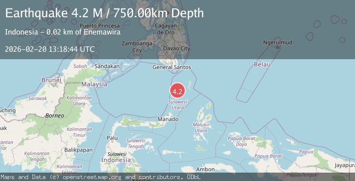
A 4.2 magnitude earthquake struck on Talaud Islands, Indonesia, at Fri, 20 Feb 2026 13:18:44 GMT. Depth: 750km. Reviewed by BMKG seismologists, this light quake occurred at a magnitude type of M.
Magnitude
4.2
M
Source
BMKG
Intensity
-
Agency Reports
1 Sources| Source | Magnitude | Depth | Time |
|---|---|---|---|
| BMKGPrimary | 4.2 | 750 km | 1 hour ago |
Earthquake Details
ManualEvent IDbmg2026dojn
Tsunami PotentialNo
Magnitude TypeM
Nearest Places
- Pulau Maselung9.3 km
- Pulau Balontohe13.0 km
- Pulau Hompetang14.9 km
- Tonggeng Tarete15.0 km
- Pulau Makoahe15.0 km
Comments
Join the discussion about this event.
Latest Earthquakes
2.7Mag
Western Australia
Time1 hour ago
Depth485.47 km
SourceVYT (Automatic)
3.8Mag
Sumba region, Indonesia
Time1 hour ago
Depth127.93 km
SourceVYT (Automatic)
2.7Mag
Minahasa, Sulawesi, Indonesia
Time1 hour ago
Depth201.29 km
SourceVYT (Automatic)
3.8Mag
Kenai Peninsula, Alaska
Time1 hour ago
Depth49.93 km
SourceVYT (Automatic)
5.8Mag
HINDU KUSH REGION, AFGHANISTAN
Time1 hour ago
Depth72.80 km
SourceGFZ (Automatic)
Nearby Earthquakes
4.0Mag
KEPULAUAN SANGIHE, INDONESIA
Time6 years ago
Depth10.00 km
SourceDJA (Automatic)
5.6Mag
KEPULAUAN SANGIHE, INDONESIA
Time5 years ago
Depth119.00 km
SourceEMSC (Automatic)
5.2Mag
KEPULAUAN SANGIHE, INDONESIA
Time13 years ago
Depth96.00 km
SourceEMSC (Automatic)
4.0Mag
KEPULAUAN SANGIHE, INDONESIA
Time5 years ago
Depth133.00 km
SourceDJA (Automatic)
5.3Mag
KEPULAUAN SANGIHE, INDONESIA
Time7 years ago
Depth10.00 km
SourceEMSC (Automatic)