Earthquake South of Bali, Indonesia
Sun, 22 Feb 2026 03:23:53 GMT
Time1 hour ago
Location
-9.3999, 114.7476
Depth
44.0 KM
Event Summary
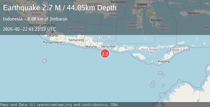
A 2.7 magnitude earthquake struck on South of Bali, Indonesia, at Sun, 22 Feb 2026 03:23:53 GMT. Depth: 44.047901km. Reviewed by BMKG seismologists, this minor quake occurred at a magnitude type of M.
Magnitude
2.7
M
Source
BMKG
Intensity
-
Agency Reports
1 Sources| Source | Magnitude | Depth | Time |
|---|---|---|---|
| BMKGPrimary | 2.7 | 44 km | 1 hour ago |
Earthquake Details
ManualEvent IDbmg2026drgx
Tsunami PotentialNo
Magnitude TypeM
Nearest Places
- 72.6 km
- 72.8 km
- 72.8 km
- 73.0 km
- 73.4 km
Comments
Join the discussion about this event.
Latest Earthquakes
2.6Mag
Antofagasta, Chile
Time1 hour ago
Depth128.78 km
SourceVYT (Automatic)
3.3Mag
Southern Alaska
Time1 hour ago
Depth139.77 km
SourceVYT (Automatic)
2.2Mag
Sulawesi, Indonesia
Time1 hour ago
Depth7.87 km
SourceBMKG
2.5Mag
Hungary
Time1 hour ago
Depth0.00 km
SourceVYT (Automatic)
1.7Mag
Fox Islands, Aleutian Islands, Alaska
Time1 hour ago
Depth74.46 km
SourceVYT (Automatic)
Nearby Earthquakes
4.4Mag
SOUTH OF BALI, INDONESIA
Time1 month ago
Depth10.00 km
SourceBMKG (Automatic)
2.8Mag
SOUTH OF BALI, INDONESIA
Time1 month ago
Depth37.00 km
SourceBMKG (Automatic)
3.0Mag
SOUTH OF BALI, INDONESIA
Time4 years ago
Depth45.00 km
SourceDJA (Automatic)
6.1Mag
SOUTH OF BALI, INDONESIA
Time14 years ago
Depth60.00 km
SourceEMSC (Automatic)
5.0Mag
SOUTH OF BALI, INDONESIA
Time7 years ago
Depth80.00 km
SourceEMSC (Automatic)